Sunday, 17 June 2012

MTB circuit of Carn nan Tri-tighearnan

Carn na Tri-tighearnan Circuit, 40 miles, 4,500 ft ascent. Ridden anticlockwise
Around a year ago I first wrote about my local hills, the high moors that rise to the southeast of Inverness. At the time I noted that a planning application had been lodged for a wind farm on the Moy Estate. This application has subsequently been approved, not by Highland Council, who ran out of time, but by Richard Dent, the Reporter appointed by the Scottish Government. His report considers the combined impact of the Moy development and the existing nearby development at Farr. It also makes note of further proposals: a practically adjacent development at Daviot (not on the current version of the annually updated SNH wind farm map) and the adjoining proposals to the south at Tom nan Clach and Glenkirk. If the developers get their way this area will soon be dominated by wind farm developments, each individually approved using language similar to that employed in Richard Dent's report, an example of which I provide below.

'.......those walking in the vicinity would experience the turbines as dominant visual features. ..... although, on the other hand, it would remain possible to experience vistas in which the wind farm would not be seen. I am therefore not persuaded that the visual impact of the wind farm in recreational terms is unacceptable.'

Unlike Richard Dent, I am persuaded that eventually the combined visual impacts of these various developments will become unacceptable, for I fear that the current applications are the thin end of an unsightly and technologically inappropriate wedge. There are sure to be applications to extend each of them in due course. Unacceptable or not, the train has well and truly left the station and the visual impact of these developments will eventually have to be accepted. Therefore I have decided to devote as much time as possible to enjoying their absence. For some time now I have been poring over my maps and making exploratory forays, keen to find a substantially off-road mountain bike route starting at my house and taking in the Streens Gorge on the River Findhorn. For aesthetic reasons I wanted the route to contain the bare minimum of road riding or pushing. All the ideas I came up with seemed overly contrived, but the penny dropped a few weeks back with the realisation that it is possible, using a combination of a few hundred metres of pushing and a track unmarked on the 1:25,000 OS map, to link the track that climbs over Beinn Bhuidhe Mor with another which leads over the Moy Estate to Ruthven.


The machinery of the wind farm constructors moves into position on the north bank of the Moy Burn near the confluence with the Allt Odhar. The peaks in the distance are those of Meall Mor

Curious feature in the bank of the Allt Odhar. The reddish line is an iron-rich layer that marks the boundary between  tills or sediments of different types. It almost encloses a rugby ball sized sandy nodule in the centre of the photo.


The feature in the image above intrigued me, for I have seen similar iron-rich layers elsewhere in the area and have thought that they might have arisen from ash deposits from a distant volcanic eruption. The example above clearly traces the boundary between two different types of gravel, making me think that the iron-rich layer may been formed by precipitation when water that has percolated through the peaty soil above meets the lower gravel layer. Does anyone know the correct explanation? The layer does not appear to be explicitly mentioned in British Geological Society Sheet Memoir 84W.


Starting the descent towards Ruthven. The warehouses of the Tomatin Distillery are evident just right of centre. 
The terrain brought to mind more exotic landscapes that I have visited abroad; the lichenous tracts of Norway's Rondane National Park and the open, rounded, ice-milled expanses of Icelandic Highlands. In the interior of Iceland low density beige tephra accumulates in the depressions of a landscape of more dense black volcanic gravel, giving the impression of vegetation where there is none. Here light patches of lichen amid the darker heather create entirely the opposite impression, that of a vegetated desert. The road across the moor is of relatively recently construction and is incongruous despite being built from local rock; no vegetation has yet gained a toe hold in its foot-high smear of crushed red rock.

The River Findhorn at Streens
This is a route best saved for dryish conditions, for the River Findhorn must be forded. I carried crocs with me to protect my feet during the crossings. I did not carry anything other than padded shorts to protect my posterior and during the ride through the gorge, which in all honesty was not much better than cycling across a field, I was worried that I may be inflicting damage on my undercarriage. A scene from Borat kept popping into my head, one where he inadvertently spends the night with a rather fruity gentleman and afterwards makes a statement to the effect that he had had a lovely evening but that his ass had been ruined in the process. Fortunately my concerns proved to be groundless, no ass ruination occurred.

View west up the Findhorn from Quilichan

There are a couple of miles of tarmac on the switchbacked climb from Drynachan after which the route cuts west across the moor, with fine views over the firth to Caithness and out west as far as Slioch, then follows the Reirach Burn to hit tarmac once more at Glengeoullie bridge. The tarmac is again shortlived, for after a couple of miles the route cuts into the Assich Forest. I rode out of the forest at Galcantray. There are a couple of routes towards Saddle Hill that would have prolonged my off-road experience but both would have involved some pushing and were not appealing at the end of what had already been a slightly longer than expected day.

So there you have it - an aesthetically pleasing 40 mile mountain bike ride through spectacular, remote and committing terrain, yet accessible from the city of Inverness. My advise is to give it a shot before the construction of the Moy windfarm completely alters the character of the area.


Labels: , ,

Wednesday, 8 June 2011

Carn nan Tri-tighearnan: enjoy the view before the Moy windfarm comes.

Look carefully and you will see an innocuous looking mast,  harbinger of a 19 turbine wind farm development on the Moy Estate.
This week I feel inspired to write a celebration of my local hills, the high moors that rise to the southeast of Inverness. As far as I know the region as a whole has no name, though it could be regarded as an outlier of the Monadhliath, or as the foothills of the Cairngorms.  Only the most dedicated hill goers will visit this area, and then only once, to claim the 615 m summit of the Graham (hill between 2000 and 2500 feet) Carn nan Tri-tighearnan, the Hill of the Three Lairds. This lack of big ticket summits, combined with the absence of a name, means that the recently proposed Moy windfarm development  is unlikely to attract the same level of protest as that at Dumnaglass in the nearby Monadhliath. Given planning permission was granted for the 33 turbine Dumnaglass scheme, the 19 turbine one at Moy will more than likely go ahead, substantially altering the character of these hills. This impending change makes the sense of space that attracts me back time and time again all the more precious. 
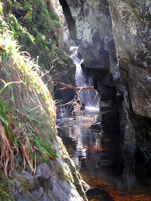
Unexpected features such as this waterfall make exploring the 'canyons' of the high moors southeast of Inverness a highly rewarding pastime
Geologically, the area is defined by the extent of granite rocks dating from the time of the great Caledonian Mountain chain, around 400 million years ago.  The area is bounded to the south by the River Findhorn; to the west by the A9 corridor; to the north by the River Nairn. To the east it loses altitude and peters out into farmland and forestry. It is an area of rounded hills with small exposures of ice-scoured granite on their summits. On the slopes and in  the hollows between lie vast quantities of glacial till, earth and rock deposited by glaciers and by the floods that accompanied their eventual melting. The defining feature of the area are the deep, steep sided channels that drain the high ground to all compass points. 

Evidence of an interstadial - peat sandwiched between layers of sand and gravel, Allt Odhar.
These channels are dramatic features, really gorges or ravines. One that contains a site of tremendous interest is the one that flows eastwards towards Moy, the Allt Odhar. It contains an interstadial site - evidence of a relatively warm period during an ice age when the ice receeded sufficiently for vegetation to briefly gain a root-hold. This is laid plain to see in the exposure on the banks of the Allt Odhar, which at first look like any other: capped by a layer or dark, heather-covered peat, from which protrude the bleached roots of bogwood - the preserved remnants of trees that were overwhelmed when the climate deteriorated. Below this is a crumbling bank of sand, gravel and stone, ice transported debris. But look closely and you will see a second layer of peat sandwiched between the till. This is the evidence of the interstadial and it has been extensively studied by those who take an interest in such things. They have found evidence of the past climate, the pollens of grasses, shrubs and -unusually for such a deposit - birch trees.

A further site of interest is to be found on the slopes above the great neolithic monuments at Clava Cairns, the Clava Shelly Clay, a clay deposit containing the shells of arctic shellfish that has been a source of valuable raw material and more recently, within the last 100 or so years, the subject of academic debate. It was originally held that the shells provided evidence that the area was once under the sea but lately, as it has become accepted that the sea level was never sufficiently high for this explanation to be correct, an even more fantastical explanation has found favour. The shelly clay are now believed to have been deposited on the seafloor between the village of Dores on the banks of Loch Ness, - now famous as the site of the Rock Ness festival - and Inverness when the relative sea level was much higher than at present. A great raft of this submarine clay, along with its cargo of shells, was gouged up by the ice stream that flowed down the Great Glen towards the Moray Firth. Before it could reach the sea it was deflected to the south by the rival ice stream that poured down the Beauly Firth, carrying vast volumes of ice from far to the northwest. It was deposited on the flanks of these hills where the puzzle it contained lay unsolved for millenia.

I usually access the hills from the Clava side, it being closest to my home.  Good landrover tracks lead over the summits of Beinn Bhuidhe Beag and Beinn Bhuidhe Mor, each providing a hill run of just under 10 km. These tracks are for the benefit of grouse shooting, for which the area is intensively managed. The heather is burned and sprayed to provide fresh growth for the birds. The hills are dotted with grouse butts, walls of turf or rock behind which the shooters lurk while the birds are driven towards them. I have remarked before that such tracks are often useful for recreational purposes, but that such utility is entirely accidental. For example they are generally used to provide access to the grounds of one particular estate. There is little incentive for estate owners to link their roads or path and in doing so to provide the type of long distance through routes that would be of great use for running or mountain biking. 

Grouse shooting has a sinister side, the poisoning of raptors and the trapping of ground dwelling predators of the grouse. An employee of this very estate - the Moy Estate - was recently successfully prosecuted for killing a red kite. This was not an isolated incident. According to the linked story in the Ross-Shire Journal, over a five week period, the remains of a further two dead red kites, six illegal baited spring traps, a trapped hen harrier, and a poison bait laced with a banned agricultural pesticide were also recovered from the estate. Disturbingly, no arrests or charges were made in connection with these additional incidents. I have my own story about illegal trapping on the Moy Estate which I will tell in a future post.

The River Findhorn east of Ruthven with the steep flanks leading up to the moorland containing the Graham summit of  Carn nan Tri-tighearnan


At the weekend I enjoyed a family picnic near Ruthven on the River Findhorn. We watched salmon leaping in a deep pool, some clearing the water completely. In the shallows upstream a seagull enjoyed its own picnic, pecking at the pink flesh of a fish who had come unstuck while impatiently trying to make his way upstream when the water level was insufficiently high. This provided me with the opportunity to make my own way home by bike, traversing this region of high moors from south to north, a pleasingly linear journey of 20 km or so, all but 3 km of which was on good tracks, with numerous exciting splashes through fords at the base of steep downhills. The trackless section was a tangled, springy mat of various lichens that I found reminiscent of Rondane National park in Norway. As is often the case, while actually pushing I vowed that it was an experience that I would never repeat, as soon as it was over my recollection was that it was not nearly as bad as I had expected. 

The Rondane-like, lichenous trackless section between the Ally Odhar and Beinn Bhuidhe Mor. The landrover track I'm heading to is visible to the left of the summit
It is always a great pleasure to arrive at a familiar place from a new direction, and it was a surprise  when, after 13 km or so immersed in this high and empty country, I reached the summit of Beinn Bhuidhe Mor and saw the land fall away to the Moray Firth. The view from this top is spectacular, the city of Inverness lies below, ringed by distant mountains; the hills of Affric, Strathfarrar, Strathconon, the Fannichs, Ben Wyvis, the Caithness hills. I am pretty sure that even  Slioch, a full fifty miles west as the crow flies, can be seen. This panorama will, thankfully, remain unmolested by the proposed windfarm development at Moy, but the view south into the great northern coires of the Cairngorms will surely be compromised. 

Hazy cloud masks the mountain panorama. Inverness and the Inner Moray and Beauly Firths from Beinn Bhuidhe Mor 
If you aspire to complete the Grahams, my advice would be to climb Carn nan Tri-tighearnan sooner rather than later, before the coming of the turbines. They cynic in me can't help but feel that windfarm developments present a win win situation for the proprietors of sporting estates. Not only can they line their pockets with the generous incentives provided, the turbines also provide a convenient way to persecute raptor populations without any risk of ending up in court.


Labels: , , , ,

Thursday, 24 December 2009

Short review of 'The Wind Farm Scam' and a bit of skiing

Welcome to the Christmas edition of my blog. It certainly feels like Christmas round these parts, we've had lying snow for well over a week now. The photo below is of  snow-laden pine and willow.


I was very pleased that last week's post elicited a response from David Mackay, the author of the book  'Sustainable energy - without the hot air'. I referred to his book in a previous post in which I declared my general opposition to the development of windfarms in upland areas. I have spent the last week reading the recently published 'The Wind Farm Scam' by retired ecologist John Etherington. His fundamental objection to wind energy as currently pursued is that it does little to reduce carbon emissions; because wind is fundamentally unpredictable and intermittent, other sources of power are required to pick up the slack when the wind drops. Wind energy makes a lot of sense if a method of storing the energy generated when the wind was blowing is available; for example as chemical energy in the batteries of electric cars or as potential energy in pumped storage hydro schemes. Feeding the energy into the grid makes much less sense because you need to have backup for when the wind stops blowing. If this backup takes the form of fossil fuel fired power stations then the carbon emission reductions claimed by the wind lobby are drastically reduced; Etherington claims they are reduced to the point that there are no savings.

I agreed with much of what Etherington had to say on the shortcomings of wind energy and found his discussion of the incentives used by government to promote it very illuminating. Unfortunately in the latter portion of the book he devoted a chapter to questioning man made climate change. His central objections were that there is no clear-cut relationship between atmospheric carbon dioxide and global mean temperature in some portions of recent history; that the medival warm period was not preceded by a rise in atmospheric carbon dioxide concentration and that little ice age ended without a rise in atmospheric carbon dioxide concentration. His book would have been stronger had he avoided straying from his area of expertise in this manner.

Predicting the future is never easy - all manner of things other than  carbon dioxide concentration affect the climate. This run of cold weather is consistent with the prediction made earlier in the year that an atmospheric effect known as the North Atlantic Oscillation may serve us up a series of colder than average winters in the coming decade. The sporting opportunities have certainly been first rate this week. The photo below was taken from the summit of Cairngorm on Tuesday, looking westwards.


Today I had my first outing on Nordic skis at the excellent but little known Slochd Nordic Ski Centre just south of Inverness on the A9. I'd never tried this lightweight and efficient method of winter travel before but I am now massively inspired to do a bit more. It is far better suited to much of the local terrain - for example  the rolling plateau of the Monadhliath - than heavy alpine touring gear.

All this snow may be great for winter sports enthusiasts, but spare a thought for the animals such as this unfortunate bunny on the trail at Slochd. Before anyone asks I didn't bring it home to eat.  I have enough turkey and chipolatas to keep me going!


Labels: , , , ,

Wednesday, 16 December 2009

Some photos from around Inverness


I've got myself a better camera as part of an effort to improve my photography. Below are some photos taken around Inverness last weekend. 


Wind turbines above Farr, to the west of the A9 just south of Inverness. Having laid down my objections to the piecemeal development of wind farms in my last post I decided to confront the contraptions face to face. It's actually quite difficult to object strongly to this particular development. Having thought the whole windfarm issue over in more detail I came to realise that when David Mackay highlighted the impossibility of completely satisfying our energy demands through renewable sources he was thinking of Britain as a whole. When I find a spare half hour I will put my republican hat on and repeat his calculations for Scotland alone. Perhaps it is really England that  needs to build nuclear power stations.


These sandmartin nests in a sand bank near River Findhorn at Ruthven reminded me of cliff dwellings. The bank was slowly renewing itself, shedding its outer skin as the sun's rays melted its frosted surface.


Mallard drake at the mouth of the River Nairn.


The night sky before the peak of  the Geminid meteor shower. You can make out Pleiades, the small cluster of stars above the tree. I wasn't lucky enough to to catch any meteors in any of the 40 or so photos I took but we did see a few reasonably impressive ones.


Labels: , ,

Tuesday, 8 December 2009

Windfarms, Sustainable Energy and Biodiversity

The run up to the Copenhagen climate talks has provoked a rash of anti windfarm chat on the outdoor blogs. I've decided to join in and air my reservations about the wind farm frenzy that is currently sweeping the nation. I wrote the text below in response to a post of Chris Townsend's but  decided to give it an airing here too.


Anyone interested in the windfarm debate would do well to read David Mackay's book 'Sustainable energy: without the hot air'.   You can download a pdf version for free using this link.


In the book he estimates how much energy we can create from renewable sources and compares that to the amount we require. His conclusion was that even if we go all out down the renewable route (area the size of Wales covered in land based wind turbines, offshore wind turbines along entire Atlantic seaboard, tidal in every suitable location, pumped storage hydro in every suitable location, lots of clean coal etc) there is still a gap between what we can generate and what we require. This gap needs to be filled and - however unpalatable it may seem - the best way to fill it is probably to build more nuclear power stations.


My question is this: if we are going to have to build more nuclear power stations anyway,why bother polluting the hills with wind farms? Should we not just bite the bullet and build the nuclear power stations? This is an important debate and one that is currently being stifled by the feel good factor created by the construction of highly visible - but ultimately ineffectual - wind farms.


Windfarm development currently under construction above the Orrin Reservoir near Inverness. Photo taken from Strathfarrar ridge.


This week's Guardian Science Weekly podcast provided a further point to throw into the mix. It featured an interview with biologist and conservation campaigner EO Wilson in which he put forward the view that there is currently an over emphasis on saving the physical environment (reducing greenhouse gas emissions to mitigate global warming) but insufficient emphasis on saving the living environment (preserving habitat and hence biodiversity, which is being lost at an increasing rate). 


Wilson's point was that if we shifted focus onto the preservation of the living environment it is likely that these actions would also have a beneficial effect on the physical environment. The reverse, however, is not necessarily true. He calls for intergovernmental action on biodiversity loss along the lines of the IPCC (Intergovernmental Panel on Climate Change).


You can hear EO Wilson present his case by following this link.


There is no doubt that these are interesting, important and contentious topics. I will be using this blog to explore them in more detail over the coming weeks.


Labels: , ,

<data:blog.pageTitle/>

This Page

has moved to a new address:

http://livingmountain.net

Sorry for the inconvenience…

Redirection provided by Blogger to WordPress Migration Service