Sunday, 17 March 2013

Ski touring Fionn Bheinn (Achnasheen)

Approaching the summit of Fionn Bheinn
Ask a child about their ambitions and they will tell you that they want be an astronaut or a Formula 1 driver. As I age my ambitions become increasingly mundane and attainable. One was achieved on Saturday, the ski descent off the back of Fionn Bheinn. The last time I toured this hill, back in 2009,  I had chased down a post-holing snowboarder named Davie. When I caught up with him on the summit he decided that he should buy himself a split-board. This is a common theme among snowboarders of a certain age, who suddenly realise the limitations of their chosen snowsport. At the time I was hampered by ill-fitting second hand equipment and an inability to ski powder, so when Davie blasted off down the back I didn't join him, knowing that it would require all my energy to retrace my route of ascent. 

Summit view to Fisherfield
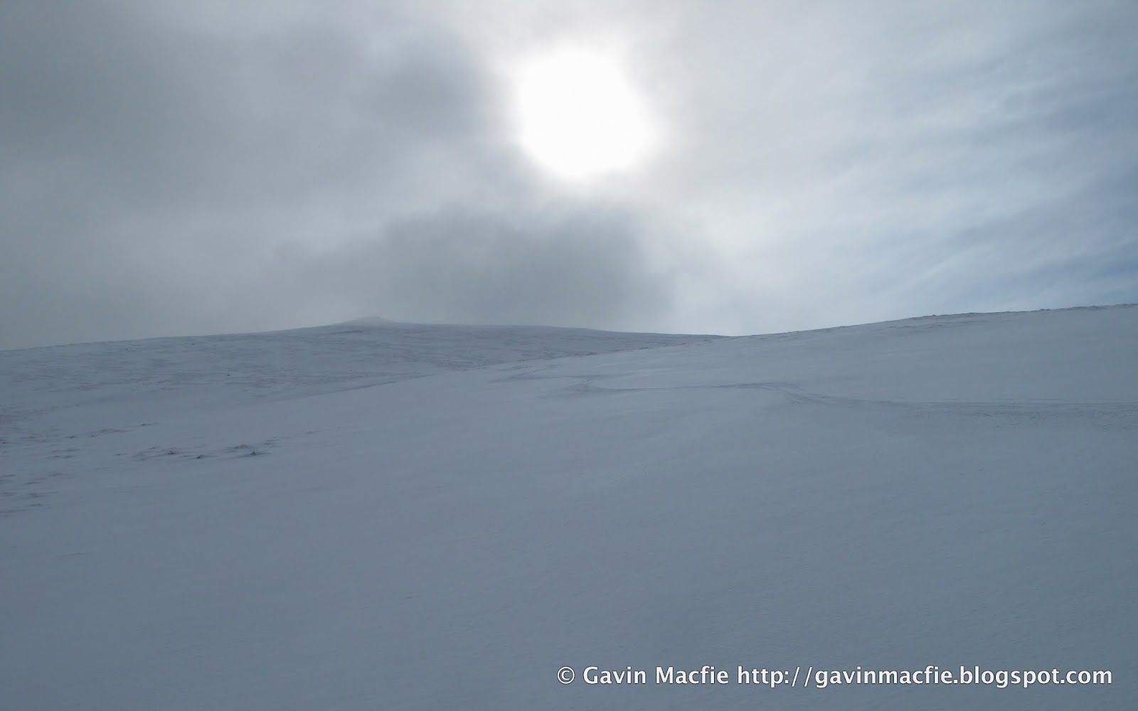
On Saturday I left Inverness with the intention of skiing either Ben Wyvis or Fionn Bheinn.  The hills to the north were plastered in snow and bathed in sunshine, inducing me to whoop with excitement. A thin veil of cloud often envelops the summit of Wyvis as the day progresses and I've yet to ski it in wholly clear conditions, so when I spotted an ominous layer of cloud lurking to the south I decided on Fionn Bheinn, reasoning that its slightly lower summit would remain clear for longer. At that point I remembered the run off the back that I had missed on 2009 and resolved to sample its delights, both skills and equipment having improved in the intervening years.

Fresh tracks and ominous cloud
In the end it stayed clear for just long enough. After briefly savouring the summit views north to Fisherfield I enjoyed a fabulous ski descent, linking powder-filled depressions in the open slope. It was so good I decided to skin up and have another shot, but alas the first whisps of cloud were starting to curl over the summit and the visibility deteriorated steadily over the 30 minutes it took me to ascend. I lingered on the summit over lunch and coffee, hoping that the cloud would clear. Unfortunately it didn't and I descended haltingly in the flat light, delighted that I had managed that one superb run before the weather changed.

Skis off time

Labels: , ,

Wednesday, 9 January 2013

Return to Glenbeg bothy

Bothying can seem to be a timeless, invariant pursuit, a chance to exchange our ever-changing, data filled world for one that our great-grandfathers would recognise. The reality is somewhat different: bothies come and go with surprising regularity. The last time I visited Glenbeg there were two bothies to choose from: we stayed in the first, a light tin shed with a pot belly stove, barely examining the dingy stone hovel that lurked behind. Lightning destroyed the tin shed in April 2012 so this time around there wasn't any choice.


A tailwind chased us in from Black Bridge on Friday night. Even fully laden, it was an exhilarating, undulating cycle, the downs providing almost enough momentum to carry the following ups. I sped ahead, relishing the opportunity to diminish fat reserves laid down over the previous fortnight's festive overconsumption. A fire and some candles made the old stone bothy cheery, but snug for our party of seven.

Saturday was windy but dry. We made an ascent of Seanna Bhraigh, delighting in the summit panorama of the northwest: the Summer Isles, Ben Mor Coigach, Stac Pollaidh, Cul Beag, Cul Mor, Suilven, and Canisp.


As we approached the bothy I was dismayed to spot a head torch twinkling outside. It was already late afternoon so anyone there would surely be staying for the night. Next time I glanced up there were two people outside, the next time three. We were in for a busy night.

On reaching the bothy we introduced ourselves to two separate parties of three and passed on the news that we were the first of seven, bringing the occupancy to a total of thirteen. Fortunately my sixth bothy sense had prompted me to bring a one man tent and I immediately set off to pitch it beside the river, on what seemed to be the only piece of flat ground in the glen.


We passed a convivial night around the fire. One of the busiest bothy nights ever for me, and in the last place I would have expected to find overcrowding. We reflected on how rare it is to encounter a bad egg in a bothy, though one of our companions had a fine tale to tell about a time when he had shared a bothy with a chap with an unfortunate tendency to urinate while sleep-walking. When our new friend's own sixth bothy sense had woken him in the night, he found this bothy bastard towering over him, lad in hand, and on the very brink of hosing him down. 

There was no hint of any such antisocial behaviour to come, but I was nonetheless relieved to depart the hearthside and retire to my tent, rather than sleep in the company of a dozen smelly men.

Labels: ,

Thursday, 20 December 2012

Yet another night march to Maol Bhuidhe


Four approaches to Maol Bhuidhe. This year's from Strathfarrar (red), 2011's from Killilan via Coire Dohmain (green), 2010's from Attadale via Bendronaig (blue) and the original from 2008 or 2009, from Killilan via Iron Lodge (orange).
Regular readers of this blog will be accustomed to the annual night march to Maol Bhuidhe, perhaps Scotland’s most remote bothy. This event has somehow become a regular fixture in my winter calendar. Dave and I have been in on three previous occasions, each time by a different route. Read about them here and hereEach time we have expected our route to be easier than those that preceded it, yet we have always found it to be harder. Last year’s was particularly awful; a fortnight later all Dave’s toenails fell off.


This year’s route was truly one for the connoisseur. Our three previous approaches all started from the west, from Killilan or from Attadale. What was missing was an eastern approach. After poring over our maps we decided to start from Glen Strathfarrar. Those familiar with this glen will know that access is problematic despite a tarmac road running its 18 mile or so length. The road was built using public money during the construction of the Monar dam and associated hydroelectric works in the 1960s. After the construction finished, the road was handed back to the control of the estates in the glen, though some provision for public vehicular access was negotiated in return for the free road. During the summer season a gatekeeper permits entry to a maximum of 25 cars a day. In winter the situation is more complex; one of the padlocks on the gate is a combination lock whose code may be obtained by phoning the Mountaineering Council of Scotland. These arrangements are of little use to bothy goers, for no vehicles may left in the glen overnight.  The good news is that access on foot or by bicycle is unrestricted. 

Maol Bhuidhe bothy with Aonach Bhuidhe behind

We encumbered ourselves as usual with obscenely heavy bags, laden with coal and beer. Dave is not inclined to apply technology to any problem that may instead be solved through a small measure of suffering. On every one of our previous approaches he has brought more equipment than may be accommodated within his pack and has carried some portion of his load, either beer or coal, in a separate bag. On this occasion his auxiliary bag was of blue fabric with thick cords attached at each end, of the type sometimes supplied by shoe shops so that one may jauntily shoulder one’s purchase on the way home. It was stuffed to the brim with coal. Had I not witnessed him perform similar feats of endurance in the past I would have thought it impossible.

We walked from the Monar Dam up Gleann Innes an Loichel on paths that should have been easy but instead were treacherous ribbons of ice. We followed a stalker’s path up to a height of around 500 m after which we followed the path of the stalked until they too petered out. This section, 7 km of trackless, peat-hagged badlands, was always going to be the crux of the route. A sleet-laden wind blasted our backs. The going was slow, each step requiring care, yet I relished our position. Any such trip involves a stack of decisions, like a house of cards. If the foundation is unsound each subsequent decision further destabilises the pile. Appropriate clothing, adequate nutrition and accurate navigation allowed us to remain warm and in control while traversing country as wild and remote as one could wish for, in the pitch dark and in horrendous weather conditions. 

Remnants of a shieling and a Victorian deer fence with Loch Cruoshie, Beinn Bheag and the snowcapped Strathfarrar Munros beyond.

Last year I had experimented with a smartphone running Viewranger mapping software. I found it unusable in rain and this year I had it inside a small Ortleib bag which allowed me to use it more easily. The terrain was so complex that it was difficult to keep going in a straight line and I soon reverted to the simplicity of a map and compass, periodically using the GPS to confirm our position.

A river barred our way, partially frozen. I selected the thickest section and gingerly shuffled across. Dave followed in my footsteps and the ice started to crack. Seemingly in slow motion he sank like a scuppered ship into knee deep, icy water, still clutching his coal bag. Shortly afterwards we hunkered down in the lee of some boulders and took stock. I thought of the book ‘The Long Walk’, the story of the hardships endured by a group of Poles during WW2. Captured by the Russians, they were sent to a labour camp in Siberia. They escaped and made their way thousands of miles overland to the safety of British India. The levels of suffering we have endured on our approaches to Maol Bhuidhe pale into insignificance in comparison, though I do at least feel I can identify with their journey more than most.

Dave’s coal bag deteriorated as we advanced over the peat-hagged badlands. One cord attachment point failed, forcing him to carry it in ever more energy consuming ways. On and on we plodded, gaining height on the flanks of An Cruachan and traversing round to the bealach from which we would descend to pick up the stalker’s path to the bothy. Eventually the ground leveled off and then started to descend. We stuck to higher ridges to avoid the ice. I was delighted to find an Argo track and we followed it. At first it followed the path on the map, then when I next checked our position I was pleased to see that it was cutting off a corner, taking a more direct route. Next time I checked all was not well. We were heading in the wrong direction, eastwards towards Pait Lodge. If there was a junction with our intended path we had missed it. 

Not so bad in the daylight. Our route crossed the peat hags to reach  the notch on the ridge just left of centre. Sgurr na Lapaich to the right. 
We headed off on a bearing to join the stalkers path where it crossed the river, tired legs unsteady on ground that was simultaneously icy and boggy. The terrain was complex, with large hummocky moraines. I struggled to maintain our course. I checked our position once more and when it was not what I expected - we were traveling parallel to the river - I attempted to use the phone GPS to navigate. This confused me even further and I started to blunder, coming to my senses after I slipped and fell on a patch of ice, my attention having been distracted by my screen. I muttered to myself as I checked and re-checked position and bearing, uncomfortably aware that we did not have time or energy to waste. After over 7 hours on the go, with a pack of military proportions, I was acutely aware that my reserves were finite, that at some point one of us would run out, and what then? We simply had to make it to the bothy.

My torchbeam illuminated a ptarmigan, flushed from beneath my feet. I started, then reflected on the weakness of the human animal: despite our equipment we would be in bad shape if we spent the night sitting out in the open, yet that  small bird can do just that,  night after night, whatever the weather.

We followed a bearing due south to gain the river. Dave lagged behind, struggling with his unwieldy load of coal. He shouted that the bag had split and that he was abandoning his cargo for collection next day. Deprived of this handicap he gained a second wind. Our spirits lifted further when we came across the partially frozen river. First I selected a section with thin ice and started to smash my way across, but the ice soon became too thick and I retreated, crossing instead at a section thick enough to bear my weight most of the way. Once across we followed the river downstream. Suspicious of my reasoning and navigating abilities, I was keen to select an error-proof route. When we got closer to the path I led us up towards it and we breathed a sigh of relief. Only 2 km of rough, icy path lay between us and shelter, dry clothes, warm tea. I counted one hundred steps at a time, often losing count and having difficulty matching my counting to my pace. 

An Cruachan

I whooped when my torchbeam revealed the whitewashed wall of Maol Bhuidhe. The time was 0350. Once inside I dropped my bag, fetched water from the burn and replaced my wet clothes. We lit a fire and I stared into the coals, my fatigued imagination interpreting their shapes in a series of convincing visions, a three dimensional dinner party scene, with around a dozen people in 1920s attire eating and chatting to the accompaniment of a three piece band. I glanced away and when my gaze returned my diners had been replaced with a troop of monkeys, black with white faces. Before retiring I opened the front door to relieve myself. The very sight of what lay outside, wind-blown sleet and soggy but icy terrain, triggered a flashback. After an hour in the bothy it seemed unthinkable that we had spent a full nine hours fighting through that weather. I started to shake through a combination of cold and some form of post-traumatic stress. Once inside my bag I warmed up and quickly drifted to sleep. 

As these ordeals have unfolded year after year I have developed an intuition that one year one of us will announce that they have become too old for the game, that we have reached the end of the road. One thing that gave me hope was Mike Pratt, the maintenance officer, who arrived unexpectedly during the Saturday of our first visit. He regaled us with stories of a life that involved spending 150 nights a year in bothies. We were enthralled by his knowledge of the various approaches to the Maol Bhuidhe and I had hoped that we might meet him here again, hear more anecdotes of his bothy life and report our own adventures to the master.


The trees of Pait Lodge, Loch Monar and Maoile Lunndaidh
As Dave read his way through the bothy book he came upon the sad news that Mike had passed away earlier this year, aged 67. We reflected that with Mike gone and most feasible routes bagged it might be time to bring this adventure to an end.

As the afternoon wore on I re-read passages from Iain R Thomson’s ‘Isolation Shepherd’. The book describes his life as a shepherd over the hill from Maol Bhuidhe in the years preceding the development of the hydroelectric scheme and documents the social history of the area. What impressed me most about this book on first reading were its tales of the hardiness of previous generations. I had similar stories drummed into me as a youth and in Mike I had come face to face with the stoical toughness of the past, a man who thought nothing of walking from his house in Inverness to carry out some work on the roof of the Kearvaig bothy near Cape Wrath. 

As I read an alternative notion occurred to me, that perhaps Mike’s passing gives us even more reason to continue testing ourselves with these winter visits, for only by doing so may we hope to come close to a genuine article now extinct.

RIP Mike.


Labels: , , ,

Tuesday, 29 May 2012

A scorching day on the South Glen Shiel Ridge


The old Road to the Isles, looking towards Cluanie
Last Friday provided a rare combination of fabulous weather and the opportunity for a spot of hillwalking. We decided on the South Glen Shiel Ridge, originally hoping to knock off the full seven Munros. However a later than intended start, a drive that took longer than my hopelessly optimistic prediction and a desire to return home at a reasonable hour to my extremely pregnant wife made a shorter day seem the more sensible option, so we contented ourselves with the eastern section of the ridge.

I left the van near the high point of the glen and cycled back to the Cluanie Inn where Paul and Tam the dog were sheltering in the shade of a tree. There are more direct routes to the ridge, but I was keen to follow the aesthetic line of the Old Road to the Isles, having been intrigued by its snaking path over the hills on previous visits to the glen. When Loch Loyne was dammed as part of a hydroelectric scheme part of the road and its impressive arch bridge disappeared beneath the waters. In times of drought the bridge emerges from its watery grave and the old road may be followed once again. 

View east along the ridge with the snowcapped peaks of the Cairngorms just visible in the centre
The weather was extremely hot, probably well into the 20s even on the tops. At first conditions were hazy, permitting only views of the adjacent peaks  but they cleared progressively as the day wore on, with grand views east as far as the snowcapped Cairngorms, incongruous in the harsh May sunshine. I could have enjoyed the last day of lift-served snowsports the following day had the urge taken me but it seemed more appropriate to head instead to the beach for a bracing dip in the sea.

Red deer hinds cool themselves on a snowpatch

Ridge leading to the summit of Aonach air Chrith (Ridge of Trembling) the scramble over was entertaining enough but no trembling was done
I took an enjoyable detour from the ridge to the airy subsidiary top to the north of Aonach air Chrith which proved to be sporting enough to quicken the pulse, the descent of the step prior to the top requiring the negotiation of either greasy chimney or airy crest. 

Sgurr a'Mhaoriach and Loch Quoich with the mighty Sgurr na Ciche on the right 
There is an intriguing track between the ridge and the Loch Quoich peaks of Sgurr a'Mhaoriach and Spidean Mealach which may could perhaps be used as part of a good mountain bike route, perhaps linking with the old Road to the Isles to make a circuit that includes a crossing of the Atlantan Bridge of Loch Loyne. The idea has certainly taken hold so I am sure that I will be back on the bike at some point to prospect it further.

During our lingering breaks on the summits I re-acquainted myself with the contours of the surrounding peaks, reigniting memories of past trips: a winter bivvy on Sgurr a'Mhaoriach to the south, a torchless benightment on Sgurr nan Ceathreamhnan to the north and plenty more that preceed or haven't made it onto this blog. 

Too hot a day for dogs
As it turned out I don't think the dog would have been capable of completing the full ridge in that heat so it was just as well we opted for the shorter day. Quite apart from anything else it leaves me with a great excuse to return to a spectacular area that never disappoints.


Labels: , ,

Thursday, 3 May 2012

Cairngorms: Overnight ski mountaineering trip


Coire an t-Sneachda

The fickle nature of Scottish winter conditions has been beautifully illustrated by this season. It got off to a promising start, but a thaw over Christmas took its toll and despite some further snowfall it all ground to a halt at the end of February, the earliest end to a season since lift-served snowsports began 50 years ago. I gave up and went skiing in France at the end of March. When I returned I waxed my skis and put them in the loft. That did the trick. The snows returned in late April, and they kept coming, allowing deep snow cover to build up over the Cairngorms. People always express surprise at April snowstorms, but they are are in fact a normal and reasonably predictable part of our weather, so much so that they have long been known in agricultural circles as 'lambing storms' for their propensity to appear, inconveniently, at the same time as the year's delicate crop of lambs.

What was unusual about this year's lambing storms is that they culminated in a week or near-constant snow over the tops before giving way to a weekend of sunshine. What's more this was not just any weekend, it was a weekend that had been reserved, months in advance, for outdoor sport. I had hoped that it might be spent be camping by a crag, climbing sun-kissed rock by day and drinking round the campfire by night, but this was not to be.

There could only be one choice of activity given the conditions, an overnight ski mountaineering trip taking in the big four tops of the Northern Cairngorms, Cairngorm itself, Ben Macdui, Carn Toul and Braeriach. I had first embarked on this route six years ago, almost to the day, when I'd only been skiing for a year. On that occasion  we decided to truncate our round by overnighting in the Garbh Coire Howff and accessing the Braeriach plateau via Garbh Coire Mor, missing out Carn Toul and Angel's Peak. Part of this decision had been driven by a reluctance to spend the night in the Corrour bothy, at the time notorious for overcrowding, mice and for being located in an area festooned with human excrement. All has changed since then, the bothy is now a cosy wee place, wood-lined with a stove and sleeping platform bunks. In order to address the jobby issue a composting toilet has been installed in a wooden outhouse. 

Pete, Stu and Colin on the steep section at the top of Allt Clach nan Taillear. Avalanche debris to the left.

After a couple of runs on the horrifically crowded piste we struck off from Cairngorm summit at at around 1300 hrs, bound for Ben Macdui. Reliable snow cover makes the jaunt to Macdui and back by far the most popular ski tour in Scotland, but it is most certainly not one of the best. The terrain is too flat, and flat terrain is the least enjoyable for touring on alpine kit. In truth lighter weight nordic gear is a far better choice for this particular tour, obviating the need to repeatedly affix and remove climbing skins. While such lightweight kit is advisable for the skier whose ambition is to bimble on the plateau, it is not the best choice for ski mountaineers seeking what the admittedly rather dated SMC guidebook describes as 'one of the finest and most challenging ski-runs in the Scottish mountains', the descent of the Tailor's burn (properly Allt Clach nan Tailler, the burn of the Tailor's Stone). My previous descent six years ago was a trying and exhausting one, the snow was heavy and the visibility was poor. This year it was revelatory, a pleasant glide on beautiful snow with the sun on our faces. I have been concentrating on improving my skiing this season and it had paid off, I'm now capable of enjoying skiing black with a pack.

Corrour Bothy and the Devil's Point

A light pack is critical for touring, but the activity itself requires so much equipment; shovel, avalanche probe and transceiver, skins and harscheisen, that I was unable to get the starting weight of my pack below 11.25 kg, including all overnight kit, food, camera and half a litre of water. Our packs were lighter back in 2006 because we didn't have any avalanche safety equipment, not that the spring conditions required them. This year, after a week of snow, it would have been rash to leave the safety gear in the car. In truth I am dubious of the benefits of transceivers in Scotland, having heard neither of anyone being saved due to having one nor of anyone perishing through the lack of one. For this trip I left crampons at home, unwilling to carry a kilo of ironmongery that wood almost certainly remain in my bag, reasoning that I could cut steps with an ice axe should I find myself on steep, icy, unskiable ground. I am glad that I didn't have to cut any steps and am now very tempted by lightweight crampons, the best of which are under 300 g. But perversely, investing in lightweight crampons would increase rather than decrease the weight of my pack, for I would actually carry them rather than leaving them at home.

The ice axes did come in handy at Corrour, where we found, to our surprise, a substantial log, over 2 m long and about 15 cm diameter. A previous visitor must have carried it in, hoping to find an axe or saw in the bothy with which to process it into stove sized lengths. We spent a at least an hour and possibly more taking turns at hacking away at the log, covering the surroundings in wood chips as if a group of beavers had picniced outside the bothy. There were three other residents who were, I think, rather bemused by the this prolonged bout of frenzied hacking. They seemed glad enough of the resulting fire though.

I was delighted to get a chance to inspect the famous Corrour toilet, an ingenious contraption that has two seats side by side. I didn't actually use the facilities, a surprising omission that I attribute to too consuming much oatmeal and not enough beer. At first it appears to have been designed with tandem crapping in mind. However on closer inspection it became clear that only one was in use. I recall reading somewhere that the toleys fall into a sack. Only once the sack is full and the hatch battened down to allow the composting process to take hold does the second seat come into play.

The day in prospect from the summit of the Devil's Point
The distant Southern Cairngorms, Carn a'Mhaim, Angel's Peak and Lochan Uaine from near the summit of Braeriach

It was wonderfully exhilarating to start another blue sky day out in the heart of the wilds of the Cairngorms.  I was outside with my porridge waiting for the sun's warmth to sweep down the flanks of the Devil's Point towards the bothy. I was the only member of the party who had any enthusiasm for starting the day with an ascent of the Devil's Point and so I strapped my skis to my pack and set off half an hour ahead of the rest of the party, ascending from the boreal spring into Scotland's island of Arctic tundra, the Cairngorm plateau. From the summit the day's sport was laid out before me; the peaks of Carn Toul, Angel's Peak and Braeriach are well defined and each provides a worthwhile ski run from its summit. The snow level was 700 m, reaching down to the high point of the Lairig Ghru. The transition between deep skiable snow and heather was a sharp one. The relatively high snowline accentuated the contrast between high and low ground, the col connecting Carn a'Mhaim and Macdui was highlighted beautifully. The distant peaks peaks of the northwest stood proud against the foreground of a practically snowless Monadhliath. The northerly Munros, Ben Mor Assynt  and Ben Klibreck,  were clearly visible, a full 80 miles to the North, as was the full length of the Caithness coast. Also clearly highlighted was the path of the Dee, the glen of which separates the northern and southern Cairngorms. 
Content after two runs of fresh tracks down Coire Gorm on the the best snow of the year
Approaching the teetering torture of the Chalamain Gap
There was a price to be paid for the wonderful descents from Sron na Lairig into Coire Gorm (it was so good we skinned up for another run), the walk out. We managed to ski to the lip of the Lairig Ghru but thereafter had to strap our skis to our packs, grit our teeth and dig deep for the descent into the gorge below, then the ascent to the torturous bouldery bed of the Chalamain Gap, a glacial meltwater channel carved in times past by vast volumes of melt water released by the Strathspey Glacier. We teetered our way through on empty legs to a soundtrack of plastic and buckles grating on granite.

Every single step required conscious effort. I constantly fought the urge to take off my pack and lie down on the ground during the toe mashing march below the Northern Coires to the Sugar Bowl car park where my van, comfortable shoes and orange and mango juice awaited. Above us the piste bashers groomed the slopes of the ski area ready for another day's skiing. The prospect was not appealing, it seemed more fitting to end the season with this unsurpassable phoenix of a trip.


Labels: , , , ,

Friday, 20 April 2012

Bog wood: the Caledonian forest and climate change

Exposed bogwood on the shores of the channel between Loch Bad an Sgalaig and Dubh Loch, near Gairloch
Anyone who has wandered the Scottish hills must have at some point been perplexed by the presence of bog wood, preserved tree stumps with radiating roots that protrude from the peat in what appear nowadays to be the most unlikely of places to find a tree. They can most often be observed where flowing water has eroded banks of peat, revealing the bog wood, the wizened, bleached tentacles of giant fossilised star fish. Some of the best examples are to be found on the edges of dammed lochs, as in the photo above, where the rise and fall of the water level gradually washes away the peat, leaving the bog wood trunks clearly exposed and undamaged, poised, spider-like on the gravel, a memorial to the great Caledonian Forest.


I recently read Emma Wood's 'Peatbogs, Plague and Potatoes', an excellent book that traces the evolution of the landscape we see around us today and provides a particularly good account of the chronology of afforestation and deforestation since the end of the last ice age. She concludes that climate change rather than human activity was responsible for the decline of the great forests that once cloaked the Scottish landscape.


Over the years I have heard many theories regarding about how Scotland transformed from forest to bog: that the trees had been chopped down by farmers; eaten by over stocked sheep and deer; consumed by wood hungry industrial activity such as shipbuilding or iron smelting. Doubtless all of those causes have played a part at various points in history and in the present day, but when evidence from pollen samples preserved in loch sediments are considered alongside indicators of past climate such as Greenland ice cores, the evidence points to the main culprit being the worsening climate. The loss of tree cover from areas with little or no human intervention, such as Rannoch Moor, supports this version of events.


The age of the landscape that we see around us today is measured not, like the age of the underlying rocks, in millions or even billions of years, but in mere thousands.  The individual landforms that make up this landscape, the glacier sculpted hills, the mounds of meltwater transported rock and gravel, did not exist until the ice receded at the end of the last ice age around 11,000 years ago.

Though the landforms themselves have maintained broadly the same shape since the ice melted, they have appeared in various guises. For a couple of hundred years after the ice melted the landscape would have been of bare tundra, home to mammoths, woolly rhinoceros, elk, wild horses, reindeer, Arctic fox and lemmings. Once soil formed from the glacial till, around 11,000 years ago, trees began to colonise the land, obscuring the landforms. At first there were tundra plants: willow, juniper and rowan. Then followed birch and hazel. Finally, 8 - 9 thousand years ago came elm, oak and Scots pine. As the climate continued to warm, this mixed forest cover reached up the flanks of the mountains. Of the tundra animals only the elk adapted, but forest animals walked over the land bridge that connected Britain to continental Europe to colonise this newly formed habitat;  red and roe deer, a massive bovine called an auroch, wild boar, badgers, squirrels, otter, beaver, lynx, bear and wolves. In short, Scotland was at least as diverse an environment as the contemporary north American wilderness, literally teeming with animal life.

The animals shared the landscape with a small population of Mesolithic hunter gatherers and it is tempting for me at least, to think of this as a semi idyllic period in which there was nothing but satisfying outdoor activity, food would have been plentiful, though the risk of predation by large animals would have been very real.

Idyllic or not, this period of a small population living in harmony with the environment was relatively short lived. By five thousand years ago Scotland had moved into the Neolithic, most of the population were at least part time farmers and had started to exert their influence over the environment, clearing trees for fields. There were perhaps only a few thousand of them, so the cleared trees were able to regenerate, until the climate took
a turn for the worse. Conditions had been getting warmer, reaching an optimum around six thousand years ago. This warming was also melting the polar ice caps and around this time the sea levels rose sufficiently to make Britain was an island, and by five thousand years or so ago the conditions were warm and dry enough to be unfavourable to large stands of trees. Meanwhile agriculture was becoming more established and Neolithic monument building was nearing its peak.

Between 4 and 2.5 thousand years ago, perhaps abetted by the cooling sulphate particles from an eruption of Iceland's Hekla volcano, the climate deteriorated. Temperatures dropped and rainfall increased, possibly an increased maritime influence on the climate as sea levels rose,  making an island and reducing the size of the landmass. The rain leached nutrients from the soil, resulting in a loss of fertility. The treeline fell as heather moorland and blanket bog displaced the forests. In 'The Scots: A Genetic Journey' Moffat and Wilson go so far as to suggest, based on evidence from studies of population genetics, that the harsh environmental conditions following the Hekla eruption in 1159 BC may have resulted in a near complete, though temporary, depopulation of western Scotland.

The climate did warm in the 1st century, but by then the damage was done. Trees couldn't recolonise the moor and bog, so forest cover was restricted to favourable pockets. There were further cold snaps between the 6th and 8th centuries and again in the 9th, just before the start of the Medieval Warm Period. The Medieval Warm Period saw a return to upland cereal growing, with areas that had not been cultivated since the peak of the Neolithic falling under the blades of iron ploughs. This same warm period saw the Norse expansion into Iceland, Greenland and beyond into North America.

It was the Norse colonies that suffered first when the medieval warm period drew to a close in the late 13th century and by 1310 the Little Ice Age was really biting in Scotland. The climate was somewhat warmer in the first half of the 16th century, but harsh, Little Ice Age, conditions, continued to affect life in Scotland intermittently until 1900. As was the case in 1159 BC, cold spikes were compounded by the cooling effect of sulphate particles from volcanic eruptions - Iceland's Laki in 1783 and Indonesia's Tambora in 1815 - with disastrous consequences for the human population.

It is often the case that gaining a little knowledge merely serves to highlight vast swathes of previously unrecognised ignorance. Learning how a few thousand years of climate history have exerted such profound changes in my immediate environment has awakened in me a great desire to find out more about the preceding billions of years of climate and the diverse landscapes and environments of the past.

Assisting me on this journey will be two recent discoveries, 'The Goldilocks Planet' by Jan Zalasiewicz and Mark Williams, subtitled 'the four billion year story of Earth's climate' and the thoroughly excellent Bits of Science blog, a great source for summaries and interpretation of recently published climate science.  Knowledge of past climates and of the factors affecting them is evolving so rapidly that books inevitably struggle to keep pace. In my opinion such studies of past climate are the most important science of our time, for it is only through understanding the past that we may predict and prepare for the climates of the future.


Labels: , , , ,

Wednesday, 15 February 2012

Ben Wyvis Ski Tour

Ben Wyvis from the Culloden Battlefield
Ben Wyvis is prominent in the view northwards from Inverness, but it is nowhere near as close as it looks. Despite being over 30 miles away by road it is still the local Munro for residents of Inverness and one that I have been up on quite a few occasions.  The only time I have been up it on skis was over four years ago, in January 2008.


Motivation for winter sports can be hard to find when it feels like spring, as it did on Sunday morning, when I saw the view of Wyvis above while wandering round the Culloden Battlefield. It looked white, but I knew that the snow was a long way from the road. Conditions were therefore far from ideal for ski touring, but it is entirely possible that this damp squib of a winter is on its way out, meaning that this might be as good as it is going to get. I decided to embark on an afternoon skitour and on returning home I marshalled my equipment and set off.


I spent the entire journey on a motivational knife edge and almost turned back on several occasions, sceptical that there would be sufficient snow to justify the considerable effort involved in accessing it. When I arrived at Garbat the car park was full and the flanks of the hill were almost entirely devoid of snow.  I groaned inwardly at the prospect of having to explain myself and my peculiar choice of equipment to the steady stream of ramblers who were no doubt at present returning from the summit in the mild spring air.


 Less than ideal ski touring conditions on Ben Wyvis


Rather than carry skis up the steep slopes to An Cabhar I continued up the glen. That way if the snow cover was insufficient for a ski descent I would be spared the effort of lugging my skis up the steep path, actually more of a stone stairway in places.  It was a fine afternoon and I was delighted to be out. I have a new pair of ski boots that are a touch on the snug side   so I consoled myself with the thought that at the very least I would be wearing my boots in a bit and making them a bit more comfortable.


View from the Bealach Mor: Little Wyvis on the left and An Cabhar to the right. Still no snow....


Snow at last! This tongue continued to the summit with only a couple of short, heathery interludes.


Just above the bealach, after carrying my skis for about 4 miles, I found a sizable bank of snow. I affixed skins and struck up it,  even then thinking that if it ran out I would at least get a few turns on the way back down. But it didn't run out, rather it provided a semi continuous field of snow all the way to the summit of An Cabhar.  The dog rolled gleefully in the granular spring snow, his arthritis briefly forgotten.


Slightly murky on top, as is so often the case with Ben Wyvis.


The descent was an exhilarating blast on granular spring snow, with over 1000 ft of vertical.  Well worth the effort, in fact had I set out earlier I would definitely have skinned up and had another run. I think that, had I been accompanied by someone else with similar motivation levels, we would have either talked each other out of going in the first place or of continuing once we had started. Self deception can be a very useful skill.

For the record it took me 3 h 40 from car to car, including a picnic stop and would have probably been quicker had I taken the direct route of ascent.

Below are some photos of the slightly better conditions I experienced in January 2008.

Emerging from the woods at Garbat with a fine tour in prospect
Skinning up to the summit

On the summit of Wyvis, low cloud rolling in from the east.


Labels: ,

Tuesday, 10 January 2012

A brief history of Scotland up to 1000 BC


 Ice age Earth at glacial maximum. Based on: "Ice age terrestrial carbon changes revisited" by Thomas J. Crowley (Global Biogeochemical Cycles, Vol. 9, 1995, pp. 377-389

I spent part of the Christmas break reading 'The Scots: A Genetic Journey' by Alistair Moffat and James F. Wilson. In this excellent book Moffat and Wilson review the recent work of population geneticists in light of the fragments of archeological evidence and, from the ancient period onwards, in terms of historical and literary evidence. What follows is a distillation of some of the notes I took while reading the book and a few snippets that I have gathered from elsewhere. If you see anything you disagree with please leave a comment and set me straight. 

The peopling of the world in general and of Scotland in particular is a subject that has long fascinated me. As a result I have previously been disappointed with history books. They  tend to focus almost exclusively on comparatively recent history, on battles and kings, running out of steam well before they start to discuss the period that I am most interested in, the mesolithic. This is entirely understandable for the hunter gatherers of the mesolithic did not many durable artefacts for us to discover. All has changed in recent years, for not only have several concrete traces of the passing of the shadowy peoples of the mesolithic been uncovered, their genetic legacy has been revealed using modern DNA analysis techniques. 

The earliest human remains that I am aware of having been discovered in the British Isles are bone and teeth from the dizzyingly early date of around 500,000 BC (Boxgrove, Sussex).  These were not modern humans like us, homo sapiens, rather they were left by earlier homonins of the species homo heidelbergensis. Flint fragments have been discovered from even earlier, 700,000 BC (Pakefield, Suffolk), close to three quarters of a million years ago. The occupants immediately prior to ourselves, homo neanderthalis, are believed to have reached the British Isles, or the northern tip of continental Europe as it was then, around  100,000 years ago, leaving behind evidence for archeologists to uncover in the south of England. In recent years the popular image of neanderthals has greatly improved; they were formerly believed to be unthinking brutes, now we credit them with culture and technology as sophisticated as that of our own distant ancestors, and by inference with minds as creative as our own. Indeed until recently the mainstream view was that the people of prehistoric times were little more advanced than apes. I would not be surprised if in the coming years we also revise our views of earlier homonins and begin to ascribe to them at least some of the traits that we used to jealously reserve for our own kind. 

Many years ago I visited Olduvai Gorge in Tanzania (now re-named Oldupai Gorge), a site that has been associated with a number of significant archaeological finds. What struck me most as I walked round the small museum on the site was a stone chopping tool dated to around two million years old, reputed to be the oldest human artefact in the world. Even more spectacular was the discovery of the fossilised footprints of a band of early humans which have been dated to 3.75 million years old. As I considered these finds I realised that we are at leading edge of literally millions of years of human history, and that we are in the privileged position of being among the first generations to have any real concept just how much has gone before.

Against this backdrop of millions of years - thousands of millennia - the history of our own species is but the blinking of an eye. The earliest modern human of our own species, homo sapiens, appears in the fossil record 150,000 years ago, and all humans currently alive can trace their ancestry to a small population who lived in Africa around 70,000 BC. Around this time it is believed that a catastrophic event almost wiped homo sapiens from the surface of the planet.  The massive amount of ash ejected by the eruption of the Toba super volcano in Indonesia led to between six and ten harsh volcanic winters.   A small number of our ancestors, perhaps only a few thousand, managed to cling on to life in the Rift Valley and it is from these people that all  modern humans are descended. A small band of these survivors embarked on a journey which would eventually result in the world being fully populated by modern humans. They walked north and sailed across the Red Sea to arrive in Arabia around 60,000 BC. There is some evidence that they mated with neanderthals prior to their dispersal along the Indian Ocean coast. Their eastwards migration was extremely rapid, taking only around 2,000 years to reach New Guinea and Australia. Hence the culture of the Australian Aboriginals, of which the early white settlers were so contemptuous, was 58,000 years old, ten times the biblical age of the earth.

In light of the very rapid eastwards migration it seems surprising that it took these early people 20,000 years, until around 40,000 BC, to get from Arabia to Europe. Particularly so when some evidence suggests that they were also established in North America more than 50,000 years ago. The reasons for these contrasting rates of colonisation are likely climatic. From around 120,000 years ago the world was in the grip of an ice age, with ice sheets covering most of what is now the UK and extending down into northern Europe. So much of the earth's water was locked up in the great ice sheets that sea levels were much lower than they are today and it was possible for early people to walk over a land bridge from Siberia to Alaska from where they spread southwards to colonise the Americas. 

A similar land bridge connected what is now Britain with continental Europe and was used by neanderthals to access the southern margins of Britain. The neanderthals were hardier than us, adapted to a cold climate. Homo sapiens spent the last ice age sheltering in what are termed the Western Refuges in southern France, where they left striking evidence of their occupation in the renowned cave paintings of Lascaux (15,000 BC) and Chauvet  (25,000 BC). 

The climate warmed and the ice began to retreat around 15,000 BC. As soon as vegetation established itself animal herds would have seek out the fresh grazing and people would have followed them. By 12,000 BC the southern Hebrides were clear of ice and we can infer from the discovery on the Island of Islay of Ahrensburgian arrowheads dated to 10,800 BC that people journeyed there by boat, most likely for the purpose of hunting, perhaps reindeer were their quarry. This was no isolated expedition; similar artefacts have been found on Tiree, Jura and Orkney.  

I was particularly impressed by this finding, for it shows that humans visited Scotland prior to the final part of the Ice Age, the Loch Lomond Readvance. The Loch Lomond Stadial started around 9,400 BC when the collapse of massive ice dams in Canada resulted in a discharge of fresh water sufficiently large to stop the Atlantic Conveyor in its tracks, shutting off the warming influence of the Gulf Stream and plunging northern Europe back into the grip of the ice. When the conveyor re-established itself the warming was rapid, occurring over perhaps only over a single decade. To a large extent the glaciers of the Loch Lomond Readvance and the catastrophic floods resulting from their melting defined the shape of the landscape we see around us today, carving the coires and steep-sided glens of the west coast mountains and transporting vast quantities of material - sand, gravel and boulders - and depositing them in glacial landforms.

The first evidence of post-glacial habitation are flint tools and hazlenuts found at Cramond in Edinburgh, dated to 8,600 - 8,200 BC, co-incident with the beginning of the current ice-free period, the Holocene interglacial. Moffat and Wilson speculate that sufficient resources may have existed at this site to sustain year-round living, though the people lived in relatively portable shelters of wood and animal hide. Not all shelters from this period were like this, some were much more substantial such as that discovered at  East Barns near Dunbar and dated to 8,000 BC. These people may have lived primarily through hunting and gathering but there is some evidence from this period that hints at the existane of the existence of a mature trading economy, such as the antler processing facility at Starr Carr in Derbyshire (8700 BC) where the sawn-off antler masks, often sported by the presenters of television programmes about prehistory, were found. These early people left their mark on the nation's DNA, bringing with them from the Western Refuges three male Y chromosome markers that together are today found in around around 5 % of the modern population of Scotland.

While the inhabitants of Scotland were enjoying what may well have been an idyllic egalitarian life of boating, bothying and plentiful leisure time in a bountiful environment from which all their needs may have been satisfied, elsewhere the technology that was to change the world was being developed. The accepted date for the development of agriculture in the Fertile Crescent (the present day Middle East) is around 9,000 BC. This marked the start of the neolithic period and the beginning of the end for the mesolithic. The first trace of the arrival of such methods in Scotland is from 3,900 BC in Balbridie in Aberdeenshire, where the remains of great halls designed to house both humans and their livestock were uncovered. It is believed that agricultural methods were brought wholesale rather than piecemeal; stock, tools and seeds were all brought by skilled agriculturalists across the North Sea at the same time, rising sea levels having made Britain an island by this time.  DNA analysis reveals that around 70 % of Scots men are descended from these early farmers, from immigrants whose DNA markers originated in the Near East less than 10,000 years ago. The reason that the farmers came to dominate over hunter gatherers is likely a consequence of the new foods available to them. Dairy products and cereal crops would have decreased weaning time and therefore increased birthrate - lactating women find it harder to conceive.  Some studies have shown that early agriculturalists were smaller than hunter gatherers of the same period, suggesting that they may have been disadvantaged nutritionally. Even so their higher birthrate would still have allowed them to outbreed mesolithic peoples.

We saw above how the climatic deterioration that followed the eruption of the Toba super volcano was so decisive in shaping human history. A similar though lesser event occurred in 1159 BC when Iceland's Hekla volcano erupted. This is the big brother of Eyafjallajokul, the volcano whose eruption which caused so much travel disruption in 2010. This eruption occurred in a climate that had already begun to deteriorate from a climatic optimum between 2,000 and 1,500 BC when summer temperatures were around 3 C higher than today. The land had been deforested for agriculture by humans and this, combined with the wetter and cooler climate, led to the spread of blanket peat. The volcanic winter that followed the Hekla eruption is likely to have been the final straw that led to depopulation of Western Scotland apart from a small number of more favourable refuges. Moffat and Wilson propose that the entire western seaboard was depopulated and once the volcanic winter ended, it was repopulated by peoples from Ireland. Hence from the 1st millennium BC, both landscape and language - peat and Gaelic - were set and similar to that which persisted up to Culloden.


Edit 05/05/12. This week's Nature has a lot to say on the topic of the peopling of the globe. Most of the earlier assertions quoted above are the subject of active debate between the archeologists and the population geneticists. 


Labels: , , ,

<data:blog.pageTitle/>

This Page

has moved to a new address:

http://livingmountain.net

Sorry for the inconvenience…

Redirection provided by Blogger to WordPress Migration Service