|
| Look carefully and you will see an innocuous looking mast, harbinger of a 19 turbine wind farm development on the Moy Estate. |
This week I feel inspired to write a celebration of my local hills, the high moors that rise to the southeast of Inverness. As far as I know the region as a whole has no name, though it could be regarded as an outlier of the Monadhliath, or as the foothills of the Cairngorms. Only the most dedicated hill goers will visit this area, and then only once, to claim the 615 m summit of the Graham (hill between 2000 and 2500 feet) Carn nan Tri-tighearnan, the Hill of the Three Lairds. This lack of big ticket summits, combined with the absence of a name, means that the
recently proposed Moy windfarm development is unlikely to attract the same
level of protest as that at
Dumnaglass in the nearby Monadhliath. Given planning permission was granted for the 33 turbine Dumnaglass scheme, the 19 turbine one at Moy will more than likely go ahead, substantially altering the character of these hills. This impending change makes the sense of space that attracts me back time and time again all the more precious.
 |
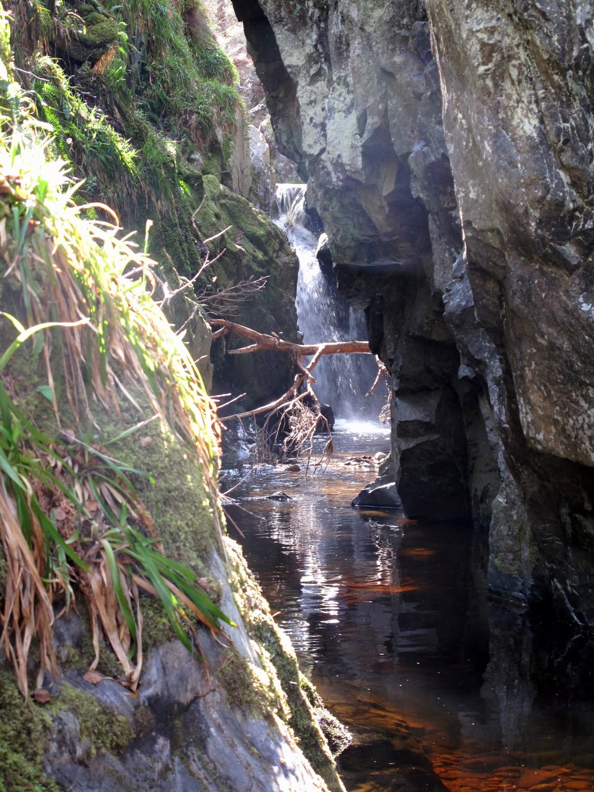
| Unexpected features such as this waterfall make exploring the 'canyons' of the high moors southeast of Inverness a highly rewarding pastime |
Geologically, the area is defined by the extent of granite rocks dating from the time of the great Caledonian Mountain chain, around 400 million years ago. The area is bounded to the south by the River Findhorn; to the west by the A9 corridor; to the north by the River Nairn. To the east it loses altitude and peters out into farmland and forestry. It is an area of rounded hills with small exposures of ice-scoured granite on their summits. On the slopes and in the hollows between lie vast quantities of glacial till, earth and rock deposited by glaciers and by the floods that accompanied their eventual melting. The defining feature of the area are the deep, steep sided channels that drain the high ground to all compass points.
 |
| Evidence of an interstadial - peat sandwiched between layers of sand and gravel, Allt Odhar. |
These channels are dramatic features, really gorges or ravines. One that contains a site of tremendous interest is the one that flows eastwards towards Moy, the
Allt Odhar. It contains an interstadial site - evidence of a relatively warm period during an ice age when the ice receeded sufficiently for vegetation to briefly gain a root-hold. This is laid plain to see in the exposure on the banks of the Allt Odhar, which at first look like any other: capped by a layer or dark, heather-covered peat, from which protrude the bleached roots of bogwood - the preserved remnants of trees that were overwhelmed when the climate deteriorated. Below this is a crumbling bank of sand, gravel and stone, ice transported debris. But look closely and you will see a second layer of peat sandwiched between the till. This is the evidence of the interstadial and it has been extensively studied by those who take an interest in such things. They have found evidence of the past climate, the pollens of grasses, shrubs and -unusually for such a deposit - birch trees.
A further site of interest is to be found on the slopes above the great neolithic monuments at Clava Cairns, the
Clava Shelly Clay, a clay deposit containing the shells of arctic shellfish that has been a source of valuable raw material and more recently, within the last 100 or so years, the subject of academic debate. It was originally held that the shells provided evidence that the area was once under the sea but lately, as it has become accepted that the sea level was never sufficiently high for this explanation to be correct, an even more fantastical explanation has found favour. The shelly clay are now believed to have been deposited on the seafloor between the village of Dores on the banks of Loch Ness, - now famous as the site of the Rock Ness festival - and Inverness when the relative sea level was much higher than at present. A great raft of this submarine clay, along with its cargo of shells, was gouged up by the ice stream that flowed down the Great Glen towards the Moray Firth. Before it could reach the sea it was deflected to the south by the rival ice stream that poured down the Beauly Firth, carrying vast volumes of ice from far to the northwest. It was deposited on the flanks of these hills where the puzzle it contained lay unsolved for millenia.
I usually access the hills from the Clava side, it being closest to my home. Good landrover tracks lead over the summits of Beinn Bhuidhe Beag and Beinn Bhuidhe Mor, each providing a hill run of just under 10 km. These tracks are for the benefit of grouse shooting, for which the area is intensively managed. The heather is burned and sprayed to provide fresh growth for the birds. The hills are dotted with grouse butts, walls of turf or rock behind which the shooters lurk while the birds are driven towards them. I have remarked before that such tracks are often useful for recreational purposes, but that such utility is entirely accidental. For example they are generally used to provide access to the grounds of one particular estate. There is little incentive for estate owners to link their roads or path and in doing so to provide the type of long distance through routes that would be of great use for running or mountain biking.
Grouse shooting has a sinister side, the poisoning of raptors and the trapping of ground dwelling predators of the grouse. An employee of this very estate - the Moy Estate - was recently successfully prosecuted for
killing a red kite. This was not an isolated incident. According to the linked story in the Ross-Shire Journal, o
ver a five week period, the remains of a further two dead red kites, six illegal baited spring traps, a trapped hen harrier, and a poison bait laced with a banned agricultural pesticide were also recovered from the estate. Disturbingly, no arrests or charges were made in connection with these additional incidents. I have my own story about illegal trapping on the Moy Estate which I will tell in a future post.
 |
The River Findhorn east of Ruthven with the steep flanks leading up to the moorland containing the Graham summit of Carn nan Tri-tighearnan
|
At the weekend I enjoyed a family picnic near Ruthven on the River Findhorn. We watched salmon leaping in a deep pool, some clearing the water completely. In the shallows upstream a seagull enjoyed its own picnic, pecking at the pink flesh of a fish who had come unstuck while impatiently trying to make his way upstream when the water level was insufficiently high. This provided me with the opportunity to make my own way home by bike, traversing this region of high moors from south to north, a pleasingly linear journey of 20 km or so, all but 3 km of which was on good tracks, with numerous exciting splashes through fords at the base of steep downhills. The trackless section was a tangled, springy mat of various lichens that I found reminiscent of Rondane National park in Norway. As is often the case, while actually pushing I vowed that it was an experience that I would never repeat, as soon as it was over my recollection was that it was not nearly as bad as I had expected.
 |
| The Rondane-like, lichenous trackless section between the Ally Odhar and Beinn Bhuidhe Mor. The landrover track I'm heading to is visible to the left of the summit |
It is always a great pleasure to arrive at a familiar place from a new direction, and it was a surprise when, after 13 km or so immersed in this high and empty country, I reached the summit of Beinn Bhuidhe Mor and saw the land fall away to the Moray Firth. The view from this top is spectacular, the city of Inverness lies below, ringed by distant mountains; the hills of Affric, Strathfarrar, Strathconon, the Fannichs, Ben Wyvis, the Caithness hills. I am pretty sure that even Slioch, a full fifty miles west as the crow flies, can be seen. This panorama will, thankfully, remain unmolested by the proposed windfarm development at Moy, but the view south into the great northern coires of the Cairngorms will surely be compromised.
 |
| Hazy cloud masks the mountain panorama. Inverness and the Inner Moray and Beauly Firths from Beinn Bhuidhe Mor |
If you aspire to complete the Grahams, my advice would be to climb Carn nan Tri-tighearnan sooner rather than later, before the coming of the turbines. They cynic in me can't help but feel that windfarm developments present a win win situation for the proprietors of sporting estates. Not only can they line their pockets with the generous incentives provided, the turbines also provide a convenient way to persecute raptor populations without any risk of ending up in court.
Labels: hill running, Hillwalking, Mountain biking, scotland, windfarms