Sunday, 17 June 2012

MTB circuit of Carn nan Tri-tighearnan

Carn na Tri-tighearnan Circuit, 40 miles, 4,500 ft ascent. Ridden anticlockwise
Around a year ago I first wrote about my local hills, the high moors that rise to the southeast of Inverness. At the time I noted that a planning application had been lodged for a wind farm on the Moy Estate. This application has subsequently been approved, not by Highland Council, who ran out of time, but by Richard Dent, the Reporter appointed by the Scottish Government. His report considers the combined impact of the Moy development and the existing nearby development at Farr. It also makes note of further proposals: a practically adjacent development at Daviot (not on the current version of the annually updated SNH wind farm map) and the adjoining proposals to the south at Tom nan Clach and Glenkirk. If the developers get their way this area will soon be dominated by wind farm developments, each individually approved using language similar to that employed in Richard Dent's report, an example of which I provide below.

'.......those walking in the vicinity would experience the turbines as dominant visual features. ..... although, on the other hand, it would remain possible to experience vistas in which the wind farm would not be seen. I am therefore not persuaded that the visual impact of the wind farm in recreational terms is unacceptable.'

Unlike Richard Dent, I am persuaded that eventually the combined visual impacts of these various developments will become unacceptable, for I fear that the current applications are the thin end of an unsightly and technologically inappropriate wedge. There are sure to be applications to extend each of them in due course. Unacceptable or not, the train has well and truly left the station and the visual impact of these developments will eventually have to be accepted. Therefore I have decided to devote as much time as possible to enjoying their absence. For some time now I have been poring over my maps and making exploratory forays, keen to find a substantially off-road mountain bike route starting at my house and taking in the Streens Gorge on the River Findhorn. For aesthetic reasons I wanted the route to contain the bare minimum of road riding or pushing. All the ideas I came up with seemed overly contrived, but the penny dropped a few weeks back with the realisation that it is possible, using a combination of a few hundred metres of pushing and a track unmarked on the 1:25,000 OS map, to link the track that climbs over Beinn Bhuidhe Mor with another which leads over the Moy Estate to Ruthven.


The machinery of the wind farm constructors moves into position on the north bank of the Moy Burn near the confluence with the Allt Odhar. The peaks in the distance are those of Meall Mor

Curious feature in the bank of the Allt Odhar. The reddish line is an iron-rich layer that marks the boundary between  tills or sediments of different types. It almost encloses a rugby ball sized sandy nodule in the centre of the photo.


The feature in the image above intrigued me, for I have seen similar iron-rich layers elsewhere in the area and have thought that they might have arisen from ash deposits from a distant volcanic eruption. The example above clearly traces the boundary between two different types of gravel, making me think that the iron-rich layer may been formed by precipitation when water that has percolated through the peaty soil above meets the lower gravel layer. Does anyone know the correct explanation? The layer does not appear to be explicitly mentioned in British Geological Society Sheet Memoir 84W.


Starting the descent towards Ruthven. The warehouses of the Tomatin Distillery are evident just right of centre. 
The terrain brought to mind more exotic landscapes that I have visited abroad; the lichenous tracts of Norway's Rondane National Park and the open, rounded, ice-milled expanses of Icelandic Highlands. In the interior of Iceland low density beige tephra accumulates in the depressions of a landscape of more dense black volcanic gravel, giving the impression of vegetation where there is none. Here light patches of lichen amid the darker heather create entirely the opposite impression, that of a vegetated desert. The road across the moor is of relatively recently construction and is incongruous despite being built from local rock; no vegetation has yet gained a toe hold in its foot-high smear of crushed red rock.

The River Findhorn at Streens
This is a route best saved for dryish conditions, for the River Findhorn must be forded. I carried crocs with me to protect my feet during the crossings. I did not carry anything other than padded shorts to protect my posterior and during the ride through the gorge, which in all honesty was not much better than cycling across a field, I was worried that I may be inflicting damage on my undercarriage. A scene from Borat kept popping into my head, one where he inadvertently spends the night with a rather fruity gentleman and afterwards makes a statement to the effect that he had had a lovely evening but that his ass had been ruined in the process. Fortunately my concerns proved to be groundless, no ass ruination occurred.

View west up the Findhorn from Quilichan

There are a couple of miles of tarmac on the switchbacked climb from Drynachan after which the route cuts west across the moor, with fine views over the firth to Caithness and out west as far as Slioch, then follows the Reirach Burn to hit tarmac once more at Glengeoullie bridge. The tarmac is again shortlived, for after a couple of miles the route cuts into the Assich Forest. I rode out of the forest at Galcantray. There are a couple of routes towards Saddle Hill that would have prolonged my off-road experience but both would have involved some pushing and were not appealing at the end of what had already been a slightly longer than expected day.

So there you have it - an aesthetically pleasing 40 mile mountain bike ride through spectacular, remote and committing terrain, yet accessible from the city of Inverness. My advise is to give it a shot before the construction of the Moy windfarm completely alters the character of the area.


Labels: , ,

Tuesday, 14 June 2011

Another MTB traverse of the Cairngorms: Aviemore to Blair Atholl


Former bridge at Carnachuin in Glen Feshie
In 1971 the Italian alpinist Reinhold Messner wrote an essay entitled 'The Murder of the Impossible', in which he criticised the trend among some mountaineers of the time of drilling holes in the rock to allow the fixing of expansion bolts. His objection was that, by using such means, men were able to get up routes that they would not otherwise have been strong or brave enough to climb. In doing so they not only disfigured the rock, they were depriving the stronger, braver climbers of future generations of the challenge of climbing such routes cleanly and in good style.

Singletrack in upper Glen Feshie
In this internet age we face an even graver threat, that of the murder of adventure itself. Nowadays almost everything - excepting the most contrived of challenges - has not only been done, it has been photographed, documented and published on blogs and web pages. Worse still, the tracks of others that have gone before can be downloaded onto GPS enabled mobile devices and slavishly followed.  What was the stuff of adventure only a few short years ago might be found today packaged up as a product and offered for sale by adventure tour operators. Even routes that have not yet been widely publicised can be researched into submission using Google Earth. 

My weekend's sport was the 75 km mountain bike ride from Aviemore to Blair Atholl via Glens Feshie, Geldie and Tilt. If you plan to take this ride on yourself I recommend that you stop reading now so that you can savour its delights through fresh eyes, untainted by the experiences of others.

Fording the Geldie Burn. Donald demonstrates the technique of removing shoes and socks in mid-stream, the biking equivalent of changing horses in mid-stream, 

The plan had been hatched by a serial plotter of cycle trips that involve trains.  Last year, while cycling near Linn of Dee, Donald had met two bikers who had cycled through from Glen Feshie. They reported only around 2 km of pushing and the seeds of our adventure were sown. We studiously avoided any further research, keen to maintain an element of surprise. A look at the map revealed about 9 km of single - or no - track between the head of Glen Feshie and Geldie Lodge, with a further 12 km leading in to Glen Tilt. The rest was on landrover tracks. Based on my recent traverse between Tromie Bridge and Dalnacardoch I predicted that the journey would take no more than six hours and we set off from Aviemore at 0930, confident that we would comfortably make the return train from Blair Atholl at 1800.

A snake in the grass near Bynack Lodge. I was surprised to see adders out and about on such a cool and damp day. Perhaps the moisture makes it easier to shed skin.
We had originally planned to take the train all the way from Inverness, but traveling by train is a frustrating pastime for the cyclist, with room for only two bikes on the smaller sprinter trains and room for a paltry half-dozen even on the mighty Highland Chieftain. The bike spaces were already taken on the southbound train, forcing us to drive to Aviemore. This lack of bicycle capacity is all the more infuriating when you learn, as I did on Saturday, that intercity services have an empty compartment at the rear of the power car which would be capable of accommodating countless bicycles. That this commodious compartment remains closed to bicycles is one of the great scandals of our age and I urge you all to write angry letters to the railway companies. 

A decomposed deer provides an unusual bit of surface interest on the approach to Glen Tilt. At this point I had a pretty good idea how the deer must have felt before it lay down for the last time..
Inconvenient though this lack of bicycle carrying capacity may be, it did add to the commitment of the journey. The penalty for missing our intended train would be having to attempt to board a later train onto which our bikes had not been booked. An ugly scene could have developed had we been turned away from this later train, for we would surely have attempted to storm the secret compartment at the rear of the power car rather than face a difficult hitch back up the A9.

The rocks in Glen Tilt are of great interest, for here James Hutton found "granite breaking and displacing the strata in every conceivable manner", proof that granites were originally in a molten state. This helped to overcome the prevailing theory of Neptunism, biblicaly inspired mumbo jumbo that held that all rocks had been deposited from the ocean (see 'Land of Mountain and Flood' page 115). It would have been good to spend longer exploring the Glen, but by then time was short.

This was tough route; a damp day meant that we didn't stop for any longer than was necessary to keep ourselves topped up with calories, yet we arrived in Blair Atholl, caked in mud, with a mere 20 minutes to spare.  The ride itself was phenomenal; we experienced the delights of the incredible upper reaches of Glen Feshie; we numbed our feet on countless river crossings; we watched an adder shed its skin while its companion hissed angrily at us from the heather; we rode singletrack that was equally unpleasant in or out of the saddle; we pounded our hands and cricked our necks on 25 km of almost continuous descent in Glen Tilt; we became acquainted  with a 1:50,000 sheet's length of fresh and wild country. We found the adventure that we sought.  

Labels: , ,

Wednesday, 8 June 2011

Carn nan Tri-tighearnan: enjoy the view before the Moy windfarm comes.

Look carefully and you will see an innocuous looking mast,  harbinger of a 19 turbine wind farm development on the Moy Estate.
This week I feel inspired to write a celebration of my local hills, the high moors that rise to the southeast of Inverness. As far as I know the region as a whole has no name, though it could be regarded as an outlier of the Monadhliath, or as the foothills of the Cairngorms.  Only the most dedicated hill goers will visit this area, and then only once, to claim the 615 m summit of the Graham (hill between 2000 and 2500 feet) Carn nan Tri-tighearnan, the Hill of the Three Lairds. This lack of big ticket summits, combined with the absence of a name, means that the recently proposed Moy windfarm development  is unlikely to attract the same level of protest as that at Dumnaglass in the nearby Monadhliath. Given planning permission was granted for the 33 turbine Dumnaglass scheme, the 19 turbine one at Moy will more than likely go ahead, substantially altering the character of these hills. This impending change makes the sense of space that attracts me back time and time again all the more precious. 
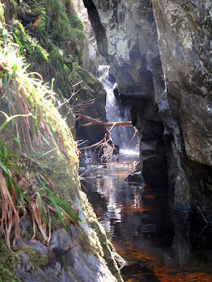
Unexpected features such as this waterfall make exploring the 'canyons' of the high moors southeast of Inverness a highly rewarding pastime
Geologically, the area is defined by the extent of granite rocks dating from the time of the great Caledonian Mountain chain, around 400 million years ago.  The area is bounded to the south by the River Findhorn; to the west by the A9 corridor; to the north by the River Nairn. To the east it loses altitude and peters out into farmland and forestry. It is an area of rounded hills with small exposures of ice-scoured granite on their summits. On the slopes and in  the hollows between lie vast quantities of glacial till, earth and rock deposited by glaciers and by the floods that accompanied their eventual melting. The defining feature of the area are the deep, steep sided channels that drain the high ground to all compass points. 

Evidence of an interstadial - peat sandwiched between layers of sand and gravel, Allt Odhar.
These channels are dramatic features, really gorges or ravines. One that contains a site of tremendous interest is the one that flows eastwards towards Moy, the Allt Odhar. It contains an interstadial site - evidence of a relatively warm period during an ice age when the ice receeded sufficiently for vegetation to briefly gain a root-hold. This is laid plain to see in the exposure on the banks of the Allt Odhar, which at first look like any other: capped by a layer or dark, heather-covered peat, from which protrude the bleached roots of bogwood - the preserved remnants of trees that were overwhelmed when the climate deteriorated. Below this is a crumbling bank of sand, gravel and stone, ice transported debris. But look closely and you will see a second layer of peat sandwiched between the till. This is the evidence of the interstadial and it has been extensively studied by those who take an interest in such things. They have found evidence of the past climate, the pollens of grasses, shrubs and -unusually for such a deposit - birch trees.

A further site of interest is to be found on the slopes above the great neolithic monuments at Clava Cairns, the Clava Shelly Clay, a clay deposit containing the shells of arctic shellfish that has been a source of valuable raw material and more recently, within the last 100 or so years, the subject of academic debate. It was originally held that the shells provided evidence that the area was once under the sea but lately, as it has become accepted that the sea level was never sufficiently high for this explanation to be correct, an even more fantastical explanation has found favour. The shelly clay are now believed to have been deposited on the seafloor between the village of Dores on the banks of Loch Ness, - now famous as the site of the Rock Ness festival - and Inverness when the relative sea level was much higher than at present. A great raft of this submarine clay, along with its cargo of shells, was gouged up by the ice stream that flowed down the Great Glen towards the Moray Firth. Before it could reach the sea it was deflected to the south by the rival ice stream that poured down the Beauly Firth, carrying vast volumes of ice from far to the northwest. It was deposited on the flanks of these hills where the puzzle it contained lay unsolved for millenia.

I usually access the hills from the Clava side, it being closest to my home.  Good landrover tracks lead over the summits of Beinn Bhuidhe Beag and Beinn Bhuidhe Mor, each providing a hill run of just under 10 km. These tracks are for the benefit of grouse shooting, for which the area is intensively managed. The heather is burned and sprayed to provide fresh growth for the birds. The hills are dotted with grouse butts, walls of turf or rock behind which the shooters lurk while the birds are driven towards them. I have remarked before that such tracks are often useful for recreational purposes, but that such utility is entirely accidental. For example they are generally used to provide access to the grounds of one particular estate. There is little incentive for estate owners to link their roads or path and in doing so to provide the type of long distance through routes that would be of great use for running or mountain biking. 

Grouse shooting has a sinister side, the poisoning of raptors and the trapping of ground dwelling predators of the grouse. An employee of this very estate - the Moy Estate - was recently successfully prosecuted for killing a red kite. This was not an isolated incident. According to the linked story in the Ross-Shire Journal, over a five week period, the remains of a further two dead red kites, six illegal baited spring traps, a trapped hen harrier, and a poison bait laced with a banned agricultural pesticide were also recovered from the estate. Disturbingly, no arrests or charges were made in connection with these additional incidents. I have my own story about illegal trapping on the Moy Estate which I will tell in a future post.

The River Findhorn east of Ruthven with the steep flanks leading up to the moorland containing the Graham summit of  Carn nan Tri-tighearnan


At the weekend I enjoyed a family picnic near Ruthven on the River Findhorn. We watched salmon leaping in a deep pool, some clearing the water completely. In the shallows upstream a seagull enjoyed its own picnic, pecking at the pink flesh of a fish who had come unstuck while impatiently trying to make his way upstream when the water level was insufficiently high. This provided me with the opportunity to make my own way home by bike, traversing this region of high moors from south to north, a pleasingly linear journey of 20 km or so, all but 3 km of which was on good tracks, with numerous exciting splashes through fords at the base of steep downhills. The trackless section was a tangled, springy mat of various lichens that I found reminiscent of Rondane National park in Norway. As is often the case, while actually pushing I vowed that it was an experience that I would never repeat, as soon as it was over my recollection was that it was not nearly as bad as I had expected. 

The Rondane-like, lichenous trackless section between the Ally Odhar and Beinn Bhuidhe Mor. The landrover track I'm heading to is visible to the left of the summit
It is always a great pleasure to arrive at a familiar place from a new direction, and it was a surprise  when, after 13 km or so immersed in this high and empty country, I reached the summit of Beinn Bhuidhe Mor and saw the land fall away to the Moray Firth. The view from this top is spectacular, the city of Inverness lies below, ringed by distant mountains; the hills of Affric, Strathfarrar, Strathconon, the Fannichs, Ben Wyvis, the Caithness hills. I am pretty sure that even  Slioch, a full fifty miles west as the crow flies, can be seen. This panorama will, thankfully, remain unmolested by the proposed windfarm development at Moy, but the view south into the great northern coires of the Cairngorms will surely be compromised. 

Hazy cloud masks the mountain panorama. Inverness and the Inner Moray and Beauly Firths from Beinn Bhuidhe Mor 
If you aspire to complete the Grahams, my advice would be to climb Carn nan Tri-tighearnan sooner rather than later, before the coming of the turbines. They cynic in me can't help but feel that windfarm developments present a win win situation for the proprietors of sporting estates. Not only can they line their pockets with the generous incentives provided, the turbines also provide a convenient way to persecute raptor populations without any risk of ending up in court.


Labels: , , , ,

Monday, 2 May 2011

Cairngorms MTB traverse: Tromie Bridge to Dalnacardoch via Gaick

Campsite by Loch an t-Seilich. The waves give an indication of the invigorating headwind that I enjoyed on the cycle out.

When travelling between Blair Atholl and Kingussie I have never previously given much thought to hinterland that lies to the east, an area roughly the size of the Monadhliath that extends between the A9 and the ski centre at Glenshee. All that will change henceforth following a highly enjoyable bike traverse from Tromie Bridge to Dalnacardoch via the Gaick Pass.

As has become my custom of late, I left home after dinner on friday. My cycle had started from Tromie Bridge near Ruthven Barracks and was surprisingly on tarmac all the way, allowing me to make my rendezvous by 2000 hrs with friends who had cycled in from the south. This allowed plenty time to enjoy our scenic campspot on the northern shore of Loch an t-Seilich, yet another fantastic wild and remote place that can be reached from my house in under two hours.

North to Gaick Lodge with Loch an t-Seilich beyond
The banter round the campfire was excellent. Three bouts of hilarity stick in my mind. The first was at the expense of Pete, who had for some reason or other removed the pannier rack from his bike. Unfortunately he remained oblivious to this modification until the start of the ride, when unloaded his panniers from the car and found he had nothing to fix them to.

The second fit of giggles resulted from some discussion about whether or not it might be possible to cook a pizza in the campfire. I opined that a Dutch oven may be the best option. This confused Neil no end. He had previously only heard the phrase 'Dutch oven' used in a euphemism that was as unfamiliar to me as the conventional definition had been to him. For those who have led lives as sheltered as my own, a Dutch Oven is when you fart in bed then hold your partner's head under the covers, thus ensuring that they experience the full force of your flatulence.  I subsequently confirmed Neil's version on urbandictionary.com. My favourite example of its usage was the following. 'Did you see the ambulance round Big James Kendall's house? Aparently he 'dutch ovened' his girlfried on the back of a night out in a curry house. She nearly died, twice.'

Loch Bhrodainn
The lavatorial theme continued as we discussed a youtube clip parodying bushcraft clown Bear Grylls entitled 'Bear Grylls; Born Shit Eater'. This is without doubt the funniest thing I have seen so far in 2011. I will warn you that it is not for the easily offended. While coprophagia is prominent  throughout, it is neither the funniest nor the most tasteless aspect of this comedy masterpiece.


Divers on Loch an Duin

We swapped car keys and parted after breakfast. An unrelenting headwind did nothing to dampen my enthusiasm for the route, past Gaick Lodge and Loch Bhrodainn. I paused to watch a pair of divers before tackling the singletrack section beside Loch an Dun. I was puzzled by a large weir above the dilapidated Sronphadruig Lodge (bothy closed - unsafe) that served no obvious hydroelectric or drinking water reservoir purpose. On my way down the glen I surmised that it was for flood control. The route was littered with the remnants of bridges and fording points, the legacy of generations of attempts keep a road open up the glen in the face of the vast quantities of shifting glacial material, sand and gravel, gradually making its way towards the sea.

North towards Sronphadruig Lodge 
I almost got my comeuppance for laughing so heartily at Pete's pannier problem. After blasting down the final descent to the A9 at top speed I arrived at Pete's car without a stuffsac that had been bungied over my rack. The sac contained a number of essential items including the keys to Pete's car and the spare battery for my mobile phone. I had been listening to some rather nice deep house on my phone throughout the ride and my battery was shot. Thankfully I only had to retrace my steps a few hundred metres to locate the missing items. It would have made a far better story if I had been forced to cycle all the way back to Gaick.....

Labels: ,

Monday, 12 October 2009

Lochaber Mountain Biking: Corrour to Tulloch via the Euston Sleeper

On friday night we boarded the 2030 sleeper train at Tulloch station. Had we stayed aboard we could have been breathing the foul air of the Metropolis by 0800 on Saturday morning. Our lungs remained uncontaminated, for it was not the bright lights of the big city that had tempted us aboard. Instead the train provided an unlikely springboard into wilderness and adventure.


The 2030 from Tulloch  (arrives London Euston at 0748)

“Absolutely pishing down out there!” exclaimed the guard smugly as we wrestled our bikes from the train at lonely Corrour station. In truth it wasn't raining that hard, but it was a dark, damp, moonless night. The weather was irrelevant; a splendid night ride of some 28 km through some extremely remote terrain awaited. We swept along the shores of Loch Ossian, down Strath Ossian into the Corrour forest, across the Laggan Dam and down a short section of the A86 to finish.


21 minutes later at Corrour - we weren't even on the train for long enough to finish our lager. First cold can I've had on a train for a long time - the winter's not all bad!

The route was predominately downhill and the tracks were smooth throughout. A first class facility for outdoor recreation has been created quite by accident; forest and estate tracks make a mountain bike route, the railway provides mechanical uplift.


Action shot in the Corrour Forest

Donald has put a Google Earth map showing the route on his blog. Danny has gone one better and made a short film of the journey. There is not much actual cycling in the film – I reckon a helmet can is the way forward!


Labels: , ,

<data:blog.pageTitle/>

This Page

has moved to a new address:

http://livingmountain.net

Sorry for the inconvenience…

Redirection provided by Blogger to WordPress Migration Service