Wednesday, 9 January 2013

Return to Glenbeg bothy

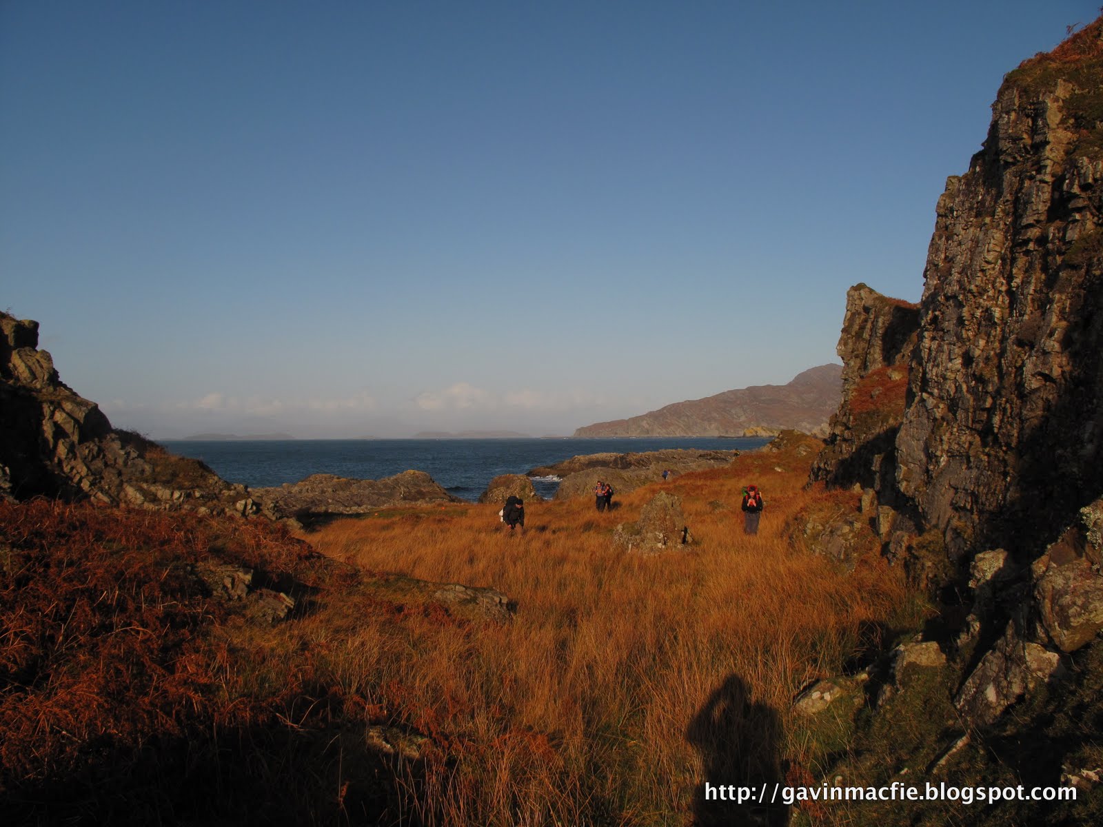
Bothying can seem to be a timeless, invariant pursuit, a chance to exchange our ever-changing, data filled world for one that our great-grandfathers would recognise. The reality is somewhat different: bothies come and go with surprising regularity. The last time I visited Glenbeg there were two bothies to choose from: we stayed in the first, a light tin shed with a pot belly stove, barely examining the dingy stone hovel that lurked behind. Lightning destroyed the tin shed in April 2012 so this time around there wasn't any choice.


A tailwind chased us in from Black Bridge on Friday night. Even fully laden, it was an exhilarating, undulating cycle, the downs providing almost enough momentum to carry the following ups. I sped ahead, relishing the opportunity to diminish fat reserves laid down over the previous fortnight's festive overconsumption. A fire and some candles made the old stone bothy cheery, but snug for our party of seven.

Saturday was windy but dry. We made an ascent of Seanna Bhraigh, delighting in the summit panorama of the northwest: the Summer Isles, Ben Mor Coigach, Stac Pollaidh, Cul Beag, Cul Mor, Suilven, and Canisp.


As we approached the bothy I was dismayed to spot a head torch twinkling outside. It was already late afternoon so anyone there would surely be staying for the night. Next time I glanced up there were two people outside, the next time three. We were in for a busy night.

On reaching the bothy we introduced ourselves to two separate parties of three and passed on the news that we were the first of seven, bringing the occupancy to a total of thirteen. Fortunately my sixth bothy sense had prompted me to bring a one man tent and I immediately set off to pitch it beside the river, on what seemed to be the only piece of flat ground in the glen.


We passed a convivial night around the fire. One of the busiest bothy nights ever for me, and in the last place I would have expected to find overcrowding. We reflected on how rare it is to encounter a bad egg in a bothy, though one of our companions had a fine tale to tell about a time when he had shared a bothy with a chap with an unfortunate tendency to urinate while sleep-walking. When our new friend's own sixth bothy sense had woken him in the night, he found this bothy bastard towering over him, lad in hand, and on the very brink of hosing him down. 

There was no hint of any such antisocial behaviour to come, but I was nonetheless relieved to depart the hearthside and retire to my tent, rather than sleep in the company of a dozen smelly men.

Labels: ,

Thursday, 20 December 2012

Yet another night march to Maol Bhuidhe


Four approaches to Maol Bhuidhe. This year's from Strathfarrar (red), 2011's from Killilan via Coire Dohmain (green), 2010's from Attadale via Bendronaig (blue) and the original from 2008 or 2009, from Killilan via Iron Lodge (orange).
Regular readers of this blog will be accustomed to the annual night march to Maol Bhuidhe, perhaps Scotland’s most remote bothy. This event has somehow become a regular fixture in my winter calendar. Dave and I have been in on three previous occasions, each time by a different route. Read about them here and hereEach time we have expected our route to be easier than those that preceded it, yet we have always found it to be harder. Last year’s was particularly awful; a fortnight later all Dave’s toenails fell off.


This year’s route was truly one for the connoisseur. Our three previous approaches all started from the west, from Killilan or from Attadale. What was missing was an eastern approach. After poring over our maps we decided to start from Glen Strathfarrar. Those familiar with this glen will know that access is problematic despite a tarmac road running its 18 mile or so length. The road was built using public money during the construction of the Monar dam and associated hydroelectric works in the 1960s. After the construction finished, the road was handed back to the control of the estates in the glen, though some provision for public vehicular access was negotiated in return for the free road. During the summer season a gatekeeper permits entry to a maximum of 25 cars a day. In winter the situation is more complex; one of the padlocks on the gate is a combination lock whose code may be obtained by phoning the Mountaineering Council of Scotland. These arrangements are of little use to bothy goers, for no vehicles may left in the glen overnight.  The good news is that access on foot or by bicycle is unrestricted. 

Maol Bhuidhe bothy with Aonach Bhuidhe behind

We encumbered ourselves as usual with obscenely heavy bags, laden with coal and beer. Dave is not inclined to apply technology to any problem that may instead be solved through a small measure of suffering. On every one of our previous approaches he has brought more equipment than may be accommodated within his pack and has carried some portion of his load, either beer or coal, in a separate bag. On this occasion his auxiliary bag was of blue fabric with thick cords attached at each end, of the type sometimes supplied by shoe shops so that one may jauntily shoulder one’s purchase on the way home. It was stuffed to the brim with coal. Had I not witnessed him perform similar feats of endurance in the past I would have thought it impossible.

We walked from the Monar Dam up Gleann Innes an Loichel on paths that should have been easy but instead were treacherous ribbons of ice. We followed a stalker’s path up to a height of around 500 m after which we followed the path of the stalked until they too petered out. This section, 7 km of trackless, peat-hagged badlands, was always going to be the crux of the route. A sleet-laden wind blasted our backs. The going was slow, each step requiring care, yet I relished our position. Any such trip involves a stack of decisions, like a house of cards. If the foundation is unsound each subsequent decision further destabilises the pile. Appropriate clothing, adequate nutrition and accurate navigation allowed us to remain warm and in control while traversing country as wild and remote as one could wish for, in the pitch dark and in horrendous weather conditions. 

Remnants of a shieling and a Victorian deer fence with Loch Cruoshie, Beinn Bheag and the snowcapped Strathfarrar Munros beyond.

Last year I had experimented with a smartphone running Viewranger mapping software. I found it unusable in rain and this year I had it inside a small Ortleib bag which allowed me to use it more easily. The terrain was so complex that it was difficult to keep going in a straight line and I soon reverted to the simplicity of a map and compass, periodically using the GPS to confirm our position.

A river barred our way, partially frozen. I selected the thickest section and gingerly shuffled across. Dave followed in my footsteps and the ice started to crack. Seemingly in slow motion he sank like a scuppered ship into knee deep, icy water, still clutching his coal bag. Shortly afterwards we hunkered down in the lee of some boulders and took stock. I thought of the book ‘The Long Walk’, the story of the hardships endured by a group of Poles during WW2. Captured by the Russians, they were sent to a labour camp in Siberia. They escaped and made their way thousands of miles overland to the safety of British India. The levels of suffering we have endured on our approaches to Maol Bhuidhe pale into insignificance in comparison, though I do at least feel I can identify with their journey more than most.

Dave’s coal bag deteriorated as we advanced over the peat-hagged badlands. One cord attachment point failed, forcing him to carry it in ever more energy consuming ways. On and on we plodded, gaining height on the flanks of An Cruachan and traversing round to the bealach from which we would descend to pick up the stalker’s path to the bothy. Eventually the ground leveled off and then started to descend. We stuck to higher ridges to avoid the ice. I was delighted to find an Argo track and we followed it. At first it followed the path on the map, then when I next checked our position I was pleased to see that it was cutting off a corner, taking a more direct route. Next time I checked all was not well. We were heading in the wrong direction, eastwards towards Pait Lodge. If there was a junction with our intended path we had missed it. 

Not so bad in the daylight. Our route crossed the peat hags to reach  the notch on the ridge just left of centre. Sgurr na Lapaich to the right. 
We headed off on a bearing to join the stalkers path where it crossed the river, tired legs unsteady on ground that was simultaneously icy and boggy. The terrain was complex, with large hummocky moraines. I struggled to maintain our course. I checked our position once more and when it was not what I expected - we were traveling parallel to the river - I attempted to use the phone GPS to navigate. This confused me even further and I started to blunder, coming to my senses after I slipped and fell on a patch of ice, my attention having been distracted by my screen. I muttered to myself as I checked and re-checked position and bearing, uncomfortably aware that we did not have time or energy to waste. After over 7 hours on the go, with a pack of military proportions, I was acutely aware that my reserves were finite, that at some point one of us would run out, and what then? We simply had to make it to the bothy.

My torchbeam illuminated a ptarmigan, flushed from beneath my feet. I started, then reflected on the weakness of the human animal: despite our equipment we would be in bad shape if we spent the night sitting out in the open, yet that  small bird can do just that,  night after night, whatever the weather.

We followed a bearing due south to gain the river. Dave lagged behind, struggling with his unwieldy load of coal. He shouted that the bag had split and that he was abandoning his cargo for collection next day. Deprived of this handicap he gained a second wind. Our spirits lifted further when we came across the partially frozen river. First I selected a section with thin ice and started to smash my way across, but the ice soon became too thick and I retreated, crossing instead at a section thick enough to bear my weight most of the way. Once across we followed the river downstream. Suspicious of my reasoning and navigating abilities, I was keen to select an error-proof route. When we got closer to the path I led us up towards it and we breathed a sigh of relief. Only 2 km of rough, icy path lay between us and shelter, dry clothes, warm tea. I counted one hundred steps at a time, often losing count and having difficulty matching my counting to my pace. 

An Cruachan

I whooped when my torchbeam revealed the whitewashed wall of Maol Bhuidhe. The time was 0350. Once inside I dropped my bag, fetched water from the burn and replaced my wet clothes. We lit a fire and I stared into the coals, my fatigued imagination interpreting their shapes in a series of convincing visions, a three dimensional dinner party scene, with around a dozen people in 1920s attire eating and chatting to the accompaniment of a three piece band. I glanced away and when my gaze returned my diners had been replaced with a troop of monkeys, black with white faces. Before retiring I opened the front door to relieve myself. The very sight of what lay outside, wind-blown sleet and soggy but icy terrain, triggered a flashback. After an hour in the bothy it seemed unthinkable that we had spent a full nine hours fighting through that weather. I started to shake through a combination of cold and some form of post-traumatic stress. Once inside my bag I warmed up and quickly drifted to sleep. 

As these ordeals have unfolded year after year I have developed an intuition that one year one of us will announce that they have become too old for the game, that we have reached the end of the road. One thing that gave me hope was Mike Pratt, the maintenance officer, who arrived unexpectedly during the Saturday of our first visit. He regaled us with stories of a life that involved spending 150 nights a year in bothies. We were enthralled by his knowledge of the various approaches to the Maol Bhuidhe and I had hoped that we might meet him here again, hear more anecdotes of his bothy life and report our own adventures to the master.


The trees of Pait Lodge, Loch Monar and Maoile Lunndaidh
As Dave read his way through the bothy book he came upon the sad news that Mike had passed away earlier this year, aged 67. We reflected that with Mike gone and most feasible routes bagged it might be time to bring this adventure to an end.

As the afternoon wore on I re-read passages from Iain R Thomson’s ‘Isolation Shepherd’. The book describes his life as a shepherd over the hill from Maol Bhuidhe in the years preceding the development of the hydroelectric scheme and documents the social history of the area. What impressed me most about this book on first reading were its tales of the hardiness of previous generations. I had similar stories drummed into me as a youth and in Mike I had come face to face with the stoical toughness of the past, a man who thought nothing of walking from his house in Inverness to carry out some work on the roof of the Kearvaig bothy near Cape Wrath. 

As I read an alternative notion occurred to me, that perhaps Mike’s passing gives us even more reason to continue testing ourselves with these winter visits, for only by doing so may we hope to come close to a genuine article now extinct.

RIP Mike.


Labels: , , ,

Thursday, 3 May 2012

Cairngorms: Overnight ski mountaineering trip


Coire an t-Sneachda

The fickle nature of Scottish winter conditions has been beautifully illustrated by this season. It got off to a promising start, but a thaw over Christmas took its toll and despite some further snowfall it all ground to a halt at the end of February, the earliest end to a season since lift-served snowsports began 50 years ago. I gave up and went skiing in France at the end of March. When I returned I waxed my skis and put them in the loft. That did the trick. The snows returned in late April, and they kept coming, allowing deep snow cover to build up over the Cairngorms. People always express surprise at April snowstorms, but they are are in fact a normal and reasonably predictable part of our weather, so much so that they have long been known in agricultural circles as 'lambing storms' for their propensity to appear, inconveniently, at the same time as the year's delicate crop of lambs.

What was unusual about this year's lambing storms is that they culminated in a week or near-constant snow over the tops before giving way to a weekend of sunshine. What's more this was not just any weekend, it was a weekend that had been reserved, months in advance, for outdoor sport. I had hoped that it might be spent be camping by a crag, climbing sun-kissed rock by day and drinking round the campfire by night, but this was not to be.

There could only be one choice of activity given the conditions, an overnight ski mountaineering trip taking in the big four tops of the Northern Cairngorms, Cairngorm itself, Ben Macdui, Carn Toul and Braeriach. I had first embarked on this route six years ago, almost to the day, when I'd only been skiing for a year. On that occasion  we decided to truncate our round by overnighting in the Garbh Coire Howff and accessing the Braeriach plateau via Garbh Coire Mor, missing out Carn Toul and Angel's Peak. Part of this decision had been driven by a reluctance to spend the night in the Corrour bothy, at the time notorious for overcrowding, mice and for being located in an area festooned with human excrement. All has changed since then, the bothy is now a cosy wee place, wood-lined with a stove and sleeping platform bunks. In order to address the jobby issue a composting toilet has been installed in a wooden outhouse. 

Pete, Stu and Colin on the steep section at the top of Allt Clach nan Taillear. Avalanche debris to the left.

After a couple of runs on the horrifically crowded piste we struck off from Cairngorm summit at at around 1300 hrs, bound for Ben Macdui. Reliable snow cover makes the jaunt to Macdui and back by far the most popular ski tour in Scotland, but it is most certainly not one of the best. The terrain is too flat, and flat terrain is the least enjoyable for touring on alpine kit. In truth lighter weight nordic gear is a far better choice for this particular tour, obviating the need to repeatedly affix and remove climbing skins. While such lightweight kit is advisable for the skier whose ambition is to bimble on the plateau, it is not the best choice for ski mountaineers seeking what the admittedly rather dated SMC guidebook describes as 'one of the finest and most challenging ski-runs in the Scottish mountains', the descent of the Tailor's burn (properly Allt Clach nan Tailler, the burn of the Tailor's Stone). My previous descent six years ago was a trying and exhausting one, the snow was heavy and the visibility was poor. This year it was revelatory, a pleasant glide on beautiful snow with the sun on our faces. I have been concentrating on improving my skiing this season and it had paid off, I'm now capable of enjoying skiing black with a pack.

Corrour Bothy and the Devil's Point

A light pack is critical for touring, but the activity itself requires so much equipment; shovel, avalanche probe and transceiver, skins and harscheisen, that I was unable to get the starting weight of my pack below 11.25 kg, including all overnight kit, food, camera and half a litre of water. Our packs were lighter back in 2006 because we didn't have any avalanche safety equipment, not that the spring conditions required them. This year, after a week of snow, it would have been rash to leave the safety gear in the car. In truth I am dubious of the benefits of transceivers in Scotland, having heard neither of anyone being saved due to having one nor of anyone perishing through the lack of one. For this trip I left crampons at home, unwilling to carry a kilo of ironmongery that wood almost certainly remain in my bag, reasoning that I could cut steps with an ice axe should I find myself on steep, icy, unskiable ground. I am glad that I didn't have to cut any steps and am now very tempted by lightweight crampons, the best of which are under 300 g. But perversely, investing in lightweight crampons would increase rather than decrease the weight of my pack, for I would actually carry them rather than leaving them at home.

The ice axes did come in handy at Corrour, where we found, to our surprise, a substantial log, over 2 m long and about 15 cm diameter. A previous visitor must have carried it in, hoping to find an axe or saw in the bothy with which to process it into stove sized lengths. We spent a at least an hour and possibly more taking turns at hacking away at the log, covering the surroundings in wood chips as if a group of beavers had picniced outside the bothy. There were three other residents who were, I think, rather bemused by the this prolonged bout of frenzied hacking. They seemed glad enough of the resulting fire though.

I was delighted to get a chance to inspect the famous Corrour toilet, an ingenious contraption that has two seats side by side. I didn't actually use the facilities, a surprising omission that I attribute to too consuming much oatmeal and not enough beer. At first it appears to have been designed with tandem crapping in mind. However on closer inspection it became clear that only one was in use. I recall reading somewhere that the toleys fall into a sack. Only once the sack is full and the hatch battened down to allow the composting process to take hold does the second seat come into play.

The day in prospect from the summit of the Devil's Point
The distant Southern Cairngorms, Carn a'Mhaim, Angel's Peak and Lochan Uaine from near the summit of Braeriach

It was wonderfully exhilarating to start another blue sky day out in the heart of the wilds of the Cairngorms.  I was outside with my porridge waiting for the sun's warmth to sweep down the flanks of the Devil's Point towards the bothy. I was the only member of the party who had any enthusiasm for starting the day with an ascent of the Devil's Point and so I strapped my skis to my pack and set off half an hour ahead of the rest of the party, ascending from the boreal spring into Scotland's island of Arctic tundra, the Cairngorm plateau. From the summit the day's sport was laid out before me; the peaks of Carn Toul, Angel's Peak and Braeriach are well defined and each provides a worthwhile ski run from its summit. The snow level was 700 m, reaching down to the high point of the Lairig Ghru. The transition between deep skiable snow and heather was a sharp one. The relatively high snowline accentuated the contrast between high and low ground, the col connecting Carn a'Mhaim and Macdui was highlighted beautifully. The distant peaks peaks of the northwest stood proud against the foreground of a practically snowless Monadhliath. The northerly Munros, Ben Mor Assynt  and Ben Klibreck,  were clearly visible, a full 80 miles to the North, as was the full length of the Caithness coast. Also clearly highlighted was the path of the Dee, the glen of which separates the northern and southern Cairngorms. 
Content after two runs of fresh tracks down Coire Gorm on the the best snow of the year
Approaching the teetering torture of the Chalamain Gap
There was a price to be paid for the wonderful descents from Sron na Lairig into Coire Gorm (it was so good we skinned up for another run), the walk out. We managed to ski to the lip of the Lairig Ghru but thereafter had to strap our skis to our packs, grit our teeth and dig deep for the descent into the gorge below, then the ascent to the torturous bouldery bed of the Chalamain Gap, a glacial meltwater channel carved in times past by vast volumes of melt water released by the Strathspey Glacier. We teetered our way through on empty legs to a soundtrack of plastic and buckles grating on granite.

Every single step required conscious effort. I constantly fought the urge to take off my pack and lie down on the ground during the toe mashing march below the Northern Coires to the Sugar Bowl car park where my van, comfortable shoes and orange and mango juice awaited. Above us the piste bashers groomed the slopes of the ski area ready for another day's skiing. The prospect was not appealing, it seemed more fitting to end the season with this unsurpassable phoenix of a trip.


Labels: , , , ,

Tuesday, 6 December 2011

Another night march to Maol Bhuidhe

Maol Bhuidhe and a snow-dusted Lurg Mhor
Maol Bhuidhe bothy lies in the heart of the great roadless quarter between the Road to the Isles to the South and the Lochcarron road to the North. It is a strong contender for the title of Scotland's Most Remote Bothy, and this inaccessibility, coupled with the many references to it in Ian R Thomson's 'Isolation Shepherd' gives it a tremendous sense of place. It has become a firm favourite of mine, a place that I know I will return to again and again for as long as I have the necessary fitness.


My friend Dave and I have become the sole participants in an esoteric but highly rewarding sport. The simple objective is to get into Maol Bhuidhe on a Friday night in the depths of winter. We've been in twice before, using a different route each time. Both times we arrived between 0200 and 0300 on Saturday morning, very tired and pretty close to the ends of our tethers.   We set out on our third route expecting it to be hard, but thinking that it couldn't possibly be any worse than the previous attempts. Deep down I knew that the second had been harder than the first, so why shouldn't the third be worse still? Just to ensure good sport we made our customary late start and loaded our bags to overflowing with beer and coal. You can read about the first two visits here. 


The three approaches tried so far. The most recent is in green.
The conditions we experienced on Friday night could not have been more different to the icy, starlit  approaches of previous visits. Horizontal rain blasted us from behind. The temperature was close to freezing, but warm enough for the rain to wash away the snow that had fallen earlier in the day. This year's route started at Killilan, but instead of cycling east up Glen Elchaig, as we had done on our first visit, we followed the River Ling to the north. We left our bikes in the deer shit-filled tin shed in Coire Domhain, which I found reminiscent of Breacan's Cave on Jura. From there we struck over the high ground towards Bealach Luib nam Feedag before dropping down to meet the path from Glen Elchaig. Compared to the other approaches it is shorter, and satisfyingly direct, but we were to find it the most testing of all.


Roaring water made itself audible over the wind as soon as we left the tin shed. Almost immediately we had to cross a wide, fast-flowing burn. It was clear that there was no easy way over and we decided just to accept wet feet and wade across rather than going off route to blunder about upsteam in the hope of finding an easy fording point. The crossing felt challenging in the fast-flowing water.  When I looked back to watch Dave cross the water was half-way up his thighs at times. We then picked up a stalker's path that wound its way from Coire Domhain towards Bealach Luib nam Feedag. The path terminated at the foaming waters of the Allt a' Choire Dubh, which at first sight appeared impassable. At the first burn we'd been worried about wet feet, but this one looked ready to sweep us away. We prospected upstream and found a wider section to try. 


The burn in Coire Domhain as we found it on Sunday. I wish I'd had the presence of mind to photograph the rivers on Friday night but at the time just getting across them seemed more important.


The flow deepened and speeded up as we approached the far bank and, feeling that a dunking was a real possibility, I remembered the advice that one should loosening one's rucsac waist bands prior to crossing a river. As I undid my waistband in midstream my pack, which was top heavy with beer and coal, unbalanced me. I pitched forward, becoming partially immersed in the icy torrent of snowmelt, bracing myself with my poles. This increased my cross sectional area and the force of the water increased, pushing me downstream. As I tried to stand back up my pack tilted forwards, counteracting my efforts. The situation was reminiscent of being strung out during a climb; it was clear that I couldn't stay where I was, yet any movement brought with it the even less palatable possibility of a full immersion in the frigid waters. There followed a period of stalemate during which Dave overtook me and started hauling himself up the bank. The icy drenching unsettled me and I knew that I had to get moving to generate some heat. 


I was trialling navigation using the Viewranger GPS software, keen to see whether or not, when run on  a waterproof smartphone like the Motorola Defy+, it could make an adequate substitute for a proper GPS. It worked well initially but as the weather deteriorated it became increasingly difficult to operate, largely because I had forgotten to disable the screen lock and had difficulty with entering my password with rain hitting and activating the touch screen. I checked it regularly as we marched over sodden, trackless terrain, at times convinced that we could see Argo cat tracks. We followed a raging burn, all the while conscious of the very real risk of hypothermia and alert for symptoms such as disorientation and muddled thought. We were aiming for a fork in the burn but never seemed to get any closer to it. I realised that the GPS had cut out and that we were now further along and to the left of the bealach. It was cold with lying snow and an icy, rain-laden wind. There followed a short period of bumbling around the complex topography during which we contrived to contour round 180 ° and track about 200 m back the way we had come. After verifying our position with the GPS I abandoned my experiment with technology,  pulled map and compass from my bag and took a bearing, delighting in the simplicity and ease of use of the old-fashioned method. 


The terrain soon levelled and eventually began to slope down. The descent was surprisingly short, for it meets the path near its high point. We had to make a third river crossing to access the path. It was straightforward enough but on any other night it would have been worthy of comment. We picked up the track and marched on, cheerful at having put the worst behind us. Our margin for error had been reduced uncomfortably close to zero up on the high ground.  I wasn't short on energy but was concerned about the creeping effects of exposure. The burn by the bothy, innocuous on previous visits, provided a counterbalance to my euphoria at the first sight of its white-washed walls. It was a fearsome prospect. We scouted downstream. Dave announced that he was going for it and promptly fell in. In the bothy all was soaked by our dripping equipment.  


Crossing the burn at Maol Bhuidhe on Sunday morning under a leaden winter sky. The picture below gives an indication of how low the level was compared to peak flow on Saturday night.
We lit a fire and began to warm up. We both agreed that the approach had been one of the toughest ordeals we had endured. Previous approaches had been long and hard but the conditions were ideal, crisp and still. We were able to rest frequently and enjoy the stars and the groaning ice of Loch Calavie. There was no such option this time round. We had to keep moving to stay warm; there could be no rest, no warmth until we reached the bothy. I do not know how long we could have continued without suffering some ill effect and ending up in a bit of a predicament - probably much longer than one might think, the human body is after all capable of far greater feats of endurance than an sodden ten mile trudge with a heavy pack. We speculated as to what might have transpired had we invited a normal person - an unsuspecting work colleague for example - along on this trip, informing them, as we ourselves partially believed at the start, that we may make it to the bothy by midnight. I honestly don't know what would happen, they would certainly find the experience a bit distressing, I know I did. 


Of the three approaches this was by far the hardest, entirely due to the weather and rivers.  But by morning we were again plotting new approaches for next year, identifying several untried ones on the map. The Maol Bhuidhe magic was working again.  We ate a late breakfast then retired to doze until 1600, keen to conserve coal for the evening. Dave left bothy once with spade, I once to collect water. Snow drifted on the flanks of Ben Dronaig, outside and all around the rivers raged, I picked a marker stone in the burn and was pleased to watch the level drop considerably over the afternoon, then dismayed to watch it rise above its previous high point by bedtime. Thankfully the waters had receded by Sunday morning and return journey took a full two hours less than the approach.


This is the burn outside the both as we found it on Sunday morning. On Saturday night the square block was totally submerged and I suspect that it was in a similar condition when we arrived on Friday night


Labels: , ,

Friday, 18 November 2011

Isle of Jura: Corryvreckan Whirlpool; Breacan's Cave and Glengarrisdale Bothy

The northern tip of Jura has eluded me on two recent visits to the island. This inaccessibility has only deepened my urge to visit, and over time a specific plan developed, to time the trip to take advantage of the large tides that accompany a full moon, to camp on the headland and to observe the Corryvreckan whirlpool below.  It is a remote objective by any standards, requiring two ferries; one to Islay and another onwards to Jura. There then remains the challenge of the ‘Long Road’, many miles of torturous single-track. Jura does have a limited bus service, but its timetable is not helpful for those who wish to reach the northern tip in a weekend, even a long one. This necessitates the use of cars, bikes or both.

Over the summer I managed to sow the seed in the minds of several friends, one of whom had a flash of inspiration and enquired about the possibility of a boat drop-off. We arranged Sandy to sail us over on the North Star on Friday, dropping us off near Uamh Bhreacain, Breacan's Cave, and to pick us up from Glengarrisdale bothy on the Sunday. I was amazed at the flexibility in landing locations provided by a boat and an experienced local skipper. The added beauty of the nautical approach was that it allowed us to carry in vast quantities of beer, much of which was consumed prior to our march down the coast to Glengarrisdale.


Steaming towards the Gulf of Corryvreckan aboard the North Star

We were regaled with tales of the sea as we waited to set sail. A 210 lb pound skate had been landed in the boat the previous week, a 6' by 7' monster. Fish that were tagged back in the 1970s are still being caught (and released). Apparently they can live for hundreds of years, which is pretty humbling and puts me off the idea of pestering them with hooks.


The whirlpool is caused by a rock pinnacle about 30 m below the surface. 


Disembarking at Bagh Gleann nam Muc near the north tip of Jura
Enjoying a beer on the beach


Campsite outside Uamh Bhreacain

I first read of Breacan's Cave in W. H. Murray’s 'The Hebrides'. Breacan was a mariner who drowned in the whirlpool. There are a number of legends: in one version he is Irish; in another he is Norse. Indeed he may have been a real man. Murray quotes Martin Martin, who wrote in 1695 that the cave contained Breacan’s stone, tomb and alter. He goes on to repeat an account by John Campbell, an early Jura schoolmaster, of a stone coffin being exhumed from the floor of the cave, but does caution that, as similar artefacts had been recovered from other caves on Jura’s wild west coast, there is not necessarily any link between the coffin and the legend.

Beyond its name, no trace of Breacan is evident in the cave. We found it as Murray had left it in 1964, sixty yards deep by fourteen wide and carpeted in deer droppings. Apart from slight dampness in the deepest recesses and on the western wall, the cave is completely dry. Consequently the pellets of deer shit that have accumulated over the millennia – a further forty seven years’ worth since Murray’s visit – have desiccated and turned to powder. They are now no more objectionable a floor covering than would be dried compost or sawdust. It provides a soft and level surface to the floor and - in the dark at least - it is possible to forget its composition, at least until it rehydrates on one’s shoes in the damp grass outside.

That said, not one of our number followed through on our initial threat to sleep in the cave. It was clear that to do so would result in clothing, equipment, hair and perhaps lungs being impregnated with dehydrated excrement. Murray had described a ‘broad stretch of turf’ extending in front of the cave. It was no bowling green, but did provide barely adequate pitches for our four tents and Mike’s tarp. A concerted forage provided sufficient driftwood for a decent fire, which we lit in the centre of the cave, gambling successfully that the smoke would find its way out. As light rain fell outside we enjoyed a primal night of drinking and smoking round the fire, marveling at the shadows cast by the flickering firelight playing on the cave’s domed roof. 

View from Uamh Bhreacain over the Gulf of Corryvreckan to Scarba


I wrote few weeks back about landscape interpretation through the ages, proposing that in Scotland there have been at least four distinct phases: the modern, scientific phase; the pseudo-scientific, biblically-inspired phase; the Celtic phase and, finally, the creation myths of the indigenous peoples. The story of Breacan is best classified under ‘Celtic’ and at first sight it appears that the story ends there. After all, the current name, Corryvreckan, translates from the Gaelic as Breacan’s coire, or cauldron, a clear reference to the whirlpool. So I was surprised to come across another translation on Wikipedia; ‘cauldron of the plaid’. This is extremely interesting, for the accompanying legend may well provide a bridge back in time, a step closer to the elusive indigenous mythology. The plaid in question was owned by the Goddess of Winter, Cailleach Bheur.  This is a legend rooted in the landscape and the seasons, it being said that as winter approaches she could be heard washing her plaid in the swirling waters of the Corryvreckan for three days – possibly a reference to the enhancement of the whirlpool’s roar by the equinoctial gales. After such treatment the plaid was pure white and became the blanket of snow that covered the land. There is something very appealing about this concept of seasonal dieties.  The Cailleach engaged in a tussle with her summer counterpart, Brighid, at the changing of the seasons. This belief system would rationalise unseasonal weather, such as an Indian summer, or the lambing storms, in terms of the departing deity briefly gaining an upper hand in the struggle.

Turbulent seas as the ebb tide roars between Jura and Scarba


In the morning I climbed the headland behind the cave, leaving our north-facing campsite to watch the sun’s first rays illuminating the cave-studded cliffs and russet-hued flanks of Scarba. I sheltered from the easterly wind in the lee of a rock. Beneath me awesome, foaming waters ripped in from the Atlantic through the gulf. A flock of cormorants bobbed in the waters of Bagh Nam Muc, gradually edging towards us in an eddy. As we descended a gully to the shore a red deer hind and a pair of shaggy goats scattered before us.  When I returned to camp for a breakfast of bacon rolls and coffee I felt contented, another ambition had been achieved.


On the march down the west coast towards Glengarrisdale

Bagh Uamh nan Giall

The coastal scenery on the walk south to Glengarrisdale was outstanding, with prominent raised beach features: wave-cut caves; stranded sea-stacks. Murray reckoned Breacan's Cave to be perhaps the most interesting on Jura, though we certainly saw more habitable caves as we picked our way be deer track and rocky shore on down the coast to Glengarrisdale: south facing and sunny; with good water supplies; even with the deer shit floor disguised beneath a coating of crisp dry bracken.  Beneath our spindly shadows, the creases in the sand at Bagh Uamh nan Giall glowed blue in the low winter sun. Four inquisitive seals regarded us from the sea between dives, their wet faces glinting. The low hills of Colonsay and Oronsay lay radiant on the horizon, to their side the open Atlantic merged with the sky. The intense Hebridean light was reflected and scattered by the ever-shifting surface of the sea, lending an almost artificially vivid quality to the autumnal reds and oranges of the dead grasses and bracken.


Glengarrisdale bothy
View from Glengarrisdale bothy towards Scarba

Glengarrisdale is a fine bothy, but it has a gloomy interior due to the selection of a semi-transparent glazing material in preference to conventional glass. This makes it a better venue for fart-lighting than for reading.  I pitched by the shore and retired to my tent after an enjoyable night round the fire, avoiding any farting, snoring and nocturnal urinations other than my own.  The North Star arrived on schedule just before noon on Sunday. Despite the tide being very low it was able to draw alongside the rocks in the centre of the bay and we boarded as we had disembarked on Friday, directly and with dry feet. A close encounter with four sea eagles on the homeward journey provided the icing on a weekend that really was just about as good as it gets.

Labels: , , , ,

Wednesday, 13 July 2011

Isle of Jura backpacking and snake charming

The wild, uninhabited west coast of Jura captured my imagination when I glimpsed it between fleeting clouds from the summit of Beinn Shanntaidh two years ago. We returned at the weekend and made two traverses from the road on the east coast to the west. The first skirted the northern flanks of the Paps to Glanbatrick with its fabulous raised beaches, the second to the Glengarrisdale bothy near the north end of the island.

We saw only two other walkers the whole weekend, but there was plenty of wildlife. At Glenbatrick we watched a seal playing in the water, barking loudly when he surfaced and even breaching on a couple of occasions. At Glengarrisdale deer and goats infested the beach. The walking was rough, pathless bog and tussocky, waist-high grass. I saw one young adder, who knows how many I missed?

Having two encounters with poisonous snakes in the space of a month made me check what to do in the event of a bite. The advise from the NHS is remain calm, immobilise the affected limb to prevent the poison spreading then seek immediate medical assistance. It sounds like they usually just keep an eye on you in hospital anyway, so if bitten when right out in the wilds I'm not sure whether it would be best to sit it out or to push on in the hope of getting to a doctor or hospital.  

Does anyone have any good snakebite stories? I don't mean the lager and cider variety........

MV Finlaggan steaming between Kennacraig and Port Askaig

Sunset from Glenbatrick, Jura
Sunset from Glenbatrick, Isle of Jura
Glengarrisdale bothy, Isle of Jura
Campspot near Glengarrisdale bothy, Isle of Jura

Labels: , , , ,

Tuesday, 19 April 2011

Culra Bothy

Culra bothy with Ben Alder beyond
I've been wanting to get into Culra for quite some time so when a couple of friends announced that they were heading in for the weekend I decided to join them for a night and have a day on the hill. I left home after dinner and arrived about 2130 just as the light was fading. For such a remote location it is incredibly accessible - the 15 km cycle to the bothy from Dalwhinnie took me a mere 1'23''; I took it pretty easy because I had my dog with me and there is a fine line between giving him a good run and animal cruelty. Without a dog I reckon it could be done comfortably in an hour.

The approach down the side of Loch Ericht is a breeze on account of a well-maintained road that provides access to a variety of extravagant gothic buildings. The one closest to the camera is a mere gatehouse; the castle beyond is partially obscured by the trees.
Culra is one of the few bothies that is genuinely useful as a base from which to hillwalk or climb. Consequently it has a reputation for being crowded, despite having three separate sections. I had planned to kip in my new tent in an effort to drive the per night cost below that of a Hilton hotel but a light drizzle dissuaded me from leaving the warmth of the bothy. The bothy was quiet on Friday night, with only our party and a couple of guys camping by the river.

All in all it was a fine weekend and one that has inspired me to pay a few more visits to this part of the Highlands.

Labels: , ,

Monday, 14 February 2011

Gleann Dubh Lighe


I'm not exactly sure how, but a haemorrhoid roll call ritual has become an integral part of our winter bothy trips.All it takes to be counted among the afflicted is to have admitted to a single previous offence. One of our number slept in a doorway about fifteen years ago. This reckless act caused his vascular structures to make a break for it,  charging headlong down his anal canal. Fortunately he was able to arrest them before they achieved external status by breaching the anal verge. He has been dormant on that front ever since but there is no going back; he knows that he is obliged to raise his hand during the bothy bum grape census.

It is always a relief when the show of hands reveals that none amongst us have succumbed since the last trip. Happily the weekend past at Gleann Dubh Lighe was such an occasion. 

Labels: ,

Tuesday, 16 November 2010

Bothy trip to Glenbeg

Bothying is the strangest - and perhaps my favourite - of all outdoor sports .  It is true that it is not for everyone. Some people just don't get it. Maybe they're not doing it properly - in order to to ensure that your outing is a satisfying one it is wise to observe a few simple rules.

Friday night's less than luxurious accommodation

Firstly, pick a suitably remote bothy, at least ten miles from the road and preferably more. Secondly, wait until it is completely dark before setting out.  Lastly and most importantly, carry an incredibly heavy sack. Coal and beer are great for increasing the weight of your sack. Sacks could be lightened considerably by taking whisky instead. This would be far more efficient, but it would hardly be sporting.

All threee golden rules were observed during the weekend's trip to the Glenbeg bothy. I've been keen to get into this one for years, ever since I opened up OS Map 20 'Beinn Dearg and Loch Broom' and caught sight of the vast area of  hill country to the north of the A835 Ullapool road - practically the only road on this empty sheet. The southern approach up Strath Vaich from just before the Glascarnoch Dam was the one that had caught my attention but we decided on the eastern  approach from Alladale instead.

The bothies at Glenbeg. The stone building to the right is the original, the silver building has been maintained by the MBA since 2000. We chose the modern one for its stove and bright interior. 

It was well after ten by the time we set off on our bikes, cycling alongside Lister's electrified enclosure. A powerful spotlight dancing on the hillside above was the first sign we saw of an approaching landrover. The keepers clearly found our behaviour a little odd, however they were completely comfortable with the equally eccentric pastime of driving round late on a wet friday night lamping for foxes.

It is possible to cycle to within 2 km of Glenbeg  but the final rough stretch and the sizable burn  immediately beside the bothy had been weighing on my mind. It was clearly very wet and still raining heavily so the burn could very well be  impassible. That would leave us in a bit of a pickle. The prospect of a dismal uphill slog in the dark with about 8 kg of coal and  the same of Deuchar's weighing down on my shoulders in order to locate a  suitable crossing point was not apealling.

A rainbow complements the autumn colours on the slopes to the north of Gleann Beag

We broke the wet cycle with a rest in the generator hut near Deanich Lodge, stuffed with enough lead-acid batteries to power a U-boat and decorated with wartime graffiti. Shortly after leaving we met the keepers again. They advised us that the rivers were indeed very high and cautioned us that we could easily be misled if we inspected the levels below the tunnel that abstracts most of the water from the Abhainn a' Ghlinne Bhig to the Glascarnoch hydro scheme. They informed us the location of a small unlocked hut where we might leave our bikes.

It was about 0100 by the time we reached the hut and we decided to doss down there and save the river crossing for the morning. It was a surprisingly cold night - not quite cold enough to make me shiver, but enough to ensure a less than completely restful night. Perhaps it is time to give my sleeping bag a clean, I have been using it for 8 years without washing it.

We didn't spot this hidden - and unmarked - gem on the way in 

The chilly night left us preoccupied  with the bothy and the prospect of fire and warmth. By 1130 on Saturday morning we were happily ensconsed by the stove in Glenbeg bothy, beer in hand. It's true that we could  have spent the Friday night in our respective beds and still have made it to the bothy by lunchtime, without even having endured a particularly early rise, but there's nothing like a gruelling approach to sharpen one's appreciation of a warm bothy and a cheery fire.

Labels: ,

Saturday, 16 October 2010

Knoydart, Knapdale and the Northwest

Last week I indulged in an extremely risky activity - I allocated  a week's precious annual leave to holiday in Scotland in October. The gamble paid off; my week coincided with something of an Indian summer. The photos accompanying this post give a flavour of the highlights.................

The week kicked off with trip to Glen Pean for a bothy weekend. This leaves Kinbreak as my only outstanding Knoydart bothy. It was a fine weekend, echoing a similar trip last year, only this time round all of us had abandoned young families and the morning lie ins were that much sweeter as a result.

On leaving the bothy I made directly for Kintyre to meet up with my own family. We took a trip to Knapdale in an attempt to seek out another young family; I was aware from the excellent beaver blog that some of the recently re-introduced beavers have produced kits this season. We didn't spot any but were very impressed by the huge dam they have built (below). I'll definitely be back in the hope of clapping eyes on the beasts themselves.


This photo of pounding sea and perching shags was taken during a stroll round the Coves near Kilberry Head. I can't quite bring myself to take advantage of the opportunity for double entendres provided by this unlikely combination of beaver and shags, feel free however  to add your own as comments below.

The paps the paps are calling me.......... The paps of Jura from near Kilberry.

The Islay ferry from the same vantage point. I have started plotting an adventure that will take full advantage of the presence of willing babysitters a stone's throw from the ferry terminal at Kennacraig. Watch this space!

The icing on the holiday cake came on the last day. I returned home slightly ahead of family and livestock and on finding a fine forecast for the Sunday I headed for An Teallach. (the photo shows the view over Strath na Sealga to Beinn Dearg Mor with the Fisherfield and Torridon Munros beyond).

Despite living very close to this fine peak I'd never climbed it before. There is some fine airy scrambling to be had on the ridge which renders it a poor choice for dogs. Many's the time I have planned to bag it, but finding myself unable to leave my four-legged friend behind, I've changed plans and tackled more canine friendly hills instead.  My fisherfield trip earlier in the year was dog-free specifically because I intended to tackle An Teallach on the last day, but when it came to it I couldn't muster the energy to take on the pinnacles while carrying a heavy sack. It was, therefore, unfinished business. With a distinct chill in the air it felt like it may have provided a fitting end to the summer season.


Labels: , , , , , ,

<data:blog.pageTitle/>

This Page

has moved to a new address:

http://livingmountain.net

Sorry for the inconvenience…

Redirection provided by Blogger to WordPress Migration Service