Monday 29 August 2011

Iceland Part 5


This is the 5th and final instalment of my recent trip to Iceland. After traversing the interior using the Kjolur route and then taking a side trip into Askja it was a pleasure to be on mostly tarmac roads when we popped out of the highlands near the town of Egilsstadir. We were on the opposite side of the island from Keflavik airport and had around 750 km of driving to do to get there. With only 3 days remaining it was clear that the Eastern Fjords and the capital Rekjavik would have to wait for next time. One location that I really wanted to visit was Skaftafjell National Park, so we made haste. We stopped in small fishing town of Djupivogur. The weather had deteriorated and mist hung in the salty air. Come morning we pressed on, pausing in Hofn to purchase supplies and some souvenirs; itchy, tassled hats of Icelandic wool and bags of dried fish. The fish was very enjoyable once it had been accepted that it was dried fish and that it tasted like dried fish. Obviously it was revolting until this acceptance had been reached.


We listened to DJ Krush's album 'Zen' as we drove this spectacular coastal road, loving the lyrics, for example "DJ fucking Krush will make your children throw furniture". I have yet to meet anyone who can reliably induce furniture throwing in youths but I imagine that such a gift would be a bit of a mixed blessing. 
One of Iceland's most photographed sites, the Jukulsalon Glacial Lagoon. After calving from the glacier the icebergs make their way under the bridge and out to sea to be pounded by the Atlantic breakers. The weather was awful, a thick, bitterly cold drizzle cloaked the area, soaking us in seconds. 
The conditions - and forecast for more of the same - made me fear for the few remaining days of the trip. It was utterly miserable, the cloud was at ground level, obscuring any view. Being outside even briefly was deeply unpleasant. Fortunately conditions improved and the tops were clear by the time we reached Skaftafell.


Campground at Skaftafell, it had the feel of a large US national park with an extensive visitor centre and vast parking area.
We woke to warm sunshine and took a stroll down to to the nearby glacier Skaftafellsjokull. This was another highlight of the trip for me, a chance to inspect a glacier that was actively retreating. We walked over various terminal moraines from 1980, 1940 and 1904, noting the increasing vegetation cover. The last was bare, the next had moss and some flowers and the oldest had grasses and dwarf shrubs. I crossed the outflow river to observe the eroded material was being deposited right at the front of the melting glacier. Pointed features were of ice, covered in a thin layer of gravel. Beside the grey ice was a huge upwelling of water from beneath the glacier, indeed most of the flow of the river was originating from this route. It was fascinating to see how the gravel and rock was deposited from the retreating glacier and then sculpted by melting of residual ice lumps and by the meltwater itself into mounds and terraces. Later that day I ran up the hill overlooking the melting glacier's snout and the penny dropped. I think I really understand now how the Scottish landscape emerged from under the ice. I hadn't previously appreciated just how dynamic these processes are - the video clip below gives a good idea.


There is a huge amount of eroded material emanating from the various glaciers along the coast and it all ends up in the vast gravel plains that extend from the base of the hills to the sea. Google Earth provides a good sense of their scale.

Some of the damage caused by the glacial floods (jokulhlaup) that accompanied the Ejafjallajokull eruption in 2010. The concrete pedestal used to support the bridge that lies twisted and almost perpendicular to its original path.
Rock formations near the black sand beach at Vik

Puffins near Vik


The Ejafjallajokull volcano is lurking in the cloud. The locals told us that the farmland in the area had benefited immensely from the volcanic ash deposited during the eruption

The Blue Lagoon, associated power plant and the nearby Northern Lights Inn. A soak in the Blue Lagoon was a fine way to end the trip.
That's the end of the trip. I've yet to meet anyone who's been disappointed by Iceland and I am no exception. It's definitely a place I'll be back to, but will probably wait until I have a party that are all capable of multi-day backpacking trips. As I mentioned in the first post, with the notable exception of car hire, Iceland isn't overly expensive, at least to those of us already conditioned by life in Rip-off Britain. You can get a bus pretty much everywhere so next time I'd probably rely on public transport.  Here's my list of activities I'd like to do when I return.

1. Tour the west, particularly Snaefellsjokull
2. Peak bagging in Kerlingarfjoll
3. The canyon walk to Dettifoss
4. Climb Mt Heroubreid
5. The classic 5 day Laugavegur trek
6. Get a proper vehicle and traverse the interior by the Askja route
7. See a volcano erupting

Labels:

Wednesday 24 August 2011

Iceland part 4

Modified 4WD vehicles normally look completely over the top, but in Iceland it was our SUV (right) that looked out of place, as if it should have been on the school run rather than fording rivers in the interior.
Coincidently, the night before we departed for Iceland, a BBC4 programme was broadcast in which TV walking woman Julia Bradbury undertook a hut to hut walk in the company of an Icelandic mountain guide.  They walked around 40 miles, ending near the troublesome Ejafjallajokul volcano.  As is generally the case when anything outdoors related is presented for a mass audience the extreme nature of the activity was repeatedly emphasised. As Julia wandered through the stunning Icelandic scenery she repeatedly commented on how she was slightly unsettled by the utter strangeness and unfamiliarity of it all and how glad she was to have some company along. I came to appreciate what she meant as we left behind the sunny skies of the northeast of Iceland and drove south, towards skies that were heavy, hazy, loaded with portent. The all pervasive dust provided a further dimming effect and by the time we reached the edge of the great lavafield our world was monochromatic. There was a particular - almost thundery - feel in the air. I wondered if being in the lee of the great icecaps would have the effect of imparting a charge to the air.

Carefully inspecting the Lindaa river prior to an uninsured crossing. No pressure, we'd only have been liable for about 20 grand if something went horribly wrong......
The outing was made more foreboding on account of the unavoidable river crossings, marked on the map with a special symbol that identified them as requiring extra care. The Lindaa river, pictured above, was knee height at its shallowest and much wider than it looks in the photo. It was disconcerting to hear the underwater river sounds - gurgling water and tumbling pebbles - transmitted so clearly into the cabin as we crossed. This was probably close to the limit of what is possible in a hired SUV and I certainly wouldn't entertain tackling any of the more ferocious and variable glacial rivers in anything other than a fully modified vehicle that was equipped with a winch. I dread to think how much it would cost to hire such a machine in Iceland. We met a lot of Germans and French who had brought their own modified Landrovers and Landcruisers with them on the ferry from Denmark. I presume that these had been purchased for forays into Africa, judging by the sand ramps, spades and jerry cans attached to the outside.

As we approached Askja we entered the famous 'lunar landscape' where US astronauts trained while preparing for the real thing. Vegetation was entirely absent. Jagged fins of black lava reared from the ground, which was composed of two types of volcanic gravel: a beige coloured, very light, honeycomb textured tephra in pieces up to the size of a small stones and a more dense black gravely ash. The two types of rock had been segregated by the forces of nature: wind, water and frost action, according to their size and density, and occurred almost distinctly, with little  mixing. This contrast between light and dark lent the land a wonderful variegated texture, with the light-coloured stones occupying the lower lying ground and hollows. From  a distance this gave the appearance of vegetation, like yellowed winter grass lining the gullies. All in all the effect was of a Zen garden. Every component of the landscape, right down to the grains of sand, appeared to have been so perfectly positioned by nature, that no amount of further rearrangement could possibly improve it.
Mt Herdoubreid (left) is a mountain I would like to return to climb some day.


The hut and campground by Askja. The crater of the big volcano behind contains Iceland's deepest lake, Oskjuvatn (220 m).


Oskjuvatn is on the left. To the right is the Viti explosion crater which is a pleasant temperature for bathing.

This photo shows how the beige tephra gives the impression of vegetation, of short, winter-yellowed grass where there is none. The single blade of grass in centre left is the only living thing in shot.

What chaotic cascade of events led to the thrift lending its flash of colour to that particular spot rather than any other?

Labels:

Wednesday 17 August 2011

Iceland part 3


This is the third instalment of my Iceland trip report. Have a read of the first and second if you haven't already.


Columnar basalt, the rock found in Fingal's Cave, the south end of the Isle of Bute and the Giant's Causeway among other places,  is a common rock in Iceland. It is at its most impressive when seen side on, an array of perfectly, uncannily, parallel columns, as if they have been chiselled into a rock face by master stonemasons. The hexagonal columns form as the rock solidifies from the molten state and are generally about a foot across. They point towards the cooling surface. They are often present as a layer of fifteen metres or so of vertical columns, straddled by layers of similar height in which the columns become strands, radiating out in all directions like the strands of a pompom.

As I wandered round Hljodaklettar I was on top of the pompom, a landscape of irregular hexagonal steps and towering basalt formations overlooking the Jokulsa river canyon. In the canyon below the river flowed against columns of basalt. The rock is so hard as to seem almost impervious to erosive forces. Of course it isn't: the river undercuts the cliff one pillar at a time, such that the surface is constantly renewed. In places the broken pillars lie jumbled like cigarette ends in an ashtray beneath the cliffs.


I am a fan of avoiding excessively detailed research prior to a trip. It is no coincidence that best parts of a trip are those that have not been read about or seen in photographs in advance. Indeed it is precisely because they engage the senses spontaneously and unexpectedly that they make such an impression. I think I found Hljodaklettar particularly enjoyable for that reason. I can only imagine how strikingly otherworldly and unnatural such a landscape would seem if seen through eyes unfamiliar with the phenomenon of columnar basalt.

I sought the opinion of the Ranger at Vesturdalur regarding our options for the rest of our trip. She revealed that she was bound for Scotland later in the summer for a coach tour to Orkney, via the Isle of Skye. She was particularly looking forward to seeing the hills purple with heather bloom. I felt drawn back towards the empty interior and was tempted to undertake another traverse. What put me off slightly was that this option would necessitate venturing onto routes not recommended for hire vehicles and undertaking potentially hazardous crossings of glacial rivers. One alternative was to continue round the ring road. Another, more appealing,  route was to head more or less due south down the east side of the canyon to Askja, deep inside the interior. From there we could take an alternative route out to the east to pick up the ring road.

There is a popular 2 day hike from Asbyrgi to Dettifoss, overnighting at the campsite we stayed at at Vesturdalur. This is one of the many things I would like to do on a return trip to Iceland. As it was I decided to run the lower section from Vesturdalur to Asbyrgi. I arranged a rendezvous point with my family and set off, reasoning that the 12 km or so would take me just over an hour. The run was a delight, I saw no-one and had an enjoyable encounter with a gyrfalcon, a bird of prey which circled me for a couple of minutes, occasionally swooping down to harry unseen prey. It called constantly, at first I thought this was for my benefit but it continued after I left. The day heated up rapidly and I was looking forward to a drink as I approached the rendezvous point, more or less on schedule. Unfortunately the rendezvous point was at the bottom of a 100 m cliff and I was at the top! In retrospect this should have been obvious but it wasn't particularly well represented on my map. This left me with an unexpected additional 10 km - 5 along the clifftops to find a point of weakness at which they could be descended and another 5 back to the RVP. I was certainly ready for that drink by the time I got it.


This is the type of scenery that would attract me back to do the Asbyrgi to Dettifoss hike

Hafragilsfoss


Dettifoss from the east side
The road to Askja. No fuel for 268 km and bridgeless rivers to ford.

The next section, through the desert to Askja, stood out as a highlight of the trip and one that merits its own post. More to come soon.......

Labels:

Wednesday 10 August 2011

Iceland continued

This is the second instalment of of my recent holiday in Iceland. Read the first here.

We camped near the top of the Hlid campsite. Below us lay a wooden church, around a previous version of which lava flows had miraculously parted during a volcanic eruption in 1729. To the south lake Myvatn with its myriad islands. We were surrounded by volcanic feature, the Hverfell crater. The small peak of Vindbergjarfjall. Behind, its peak obscured by its foothills, a pointed volcano, Hidarfjall. 


Our drive to the Myvatn Nature Baths took us into an amazing area to the northeast of the lake. The rock was orange, like that at Kerlingfjoll, crossed by crumpled black lava flows. Geothermal vents dotted the landscape, ceaselessly erupting steam. Buckminster Fuller-style geodesic structures were sited beside the vents, adding a touch of Icelandic style. The lakes were a vivid cyan. Icelandic horses grazed incongruously a green field amid the desolation. The overwhelming features were the two roaring steam holes, kicking out more steam than the refinery at Grangemouth accompanied by the noise of many jet engines.


What was described as a pseudo crater on the south side of the lake.


There were one or two flies about. The only time I have seen similarly dense swarms of flies is in a documentary about Lake Victoria. Fortunately they didn't bite.


Inside the Hverfjell crater, about 1 km in diameter. The area around Lake Myvatn is truly remarkable and littered with interesting features. It would be easy to spend several days in the area and many people do, making it quite busy by Icelandic standards, but we were inspired to move on, bound for Iceland's greatest river canyon, Jokulsargjufur, inside which lurks Europe's most voluminous waterfall, Dettifoss.

Along the way we stopped at another geothermal area. Great vistas, moody skies and an overwhelming aroma of egg.


Up until recently road access to the eastern side of Dettifoss has been much easier, but the road up to the west side has recently been upgraded to a decent gravel road. A short walk through an amazing landscape of basalt blocks is required to view the falls, though the spray can been seen billowing out of the canyon for some distance. The fall was mesmerising, a wide curtain of dirty glacial water, thundering into a columnar basalt-lined canyon. Towards its right edge the water hit a protruberance on the way down and against the backdrop of scrolling water it appeared to billow upwards. I could have watched it all day, but it was already late and with Erin fast asleep in the jeep we had to visit the falls one at a time. I cooked up some pasta in the car park while Gaener took her turn - the glamour of life on the road!


A rainbow marked the site as we descended to the Vesturdaler campsite. There were high trees - willow and birch, rose-style basalt formations,  set in an impressive canyon. This quiet and uncrowded campsite was one of the best we found in Iceland.


It was a pleasant evening so after erecting the tent we wandered until 2300, which would be midnight in the UK. It was still broad daylight, despite it being the end of July, over a month past the summer solstice. In the north of Scotland we experience this perpetual midsummer light only fleetingly, there is no time to relax into it, by the time one realises it is upon us it is already slipping away.  In the north of Iceland, between 65.5 and 66 degrees north, there is no darkness for months at a stretch, perpetual light becomes the normal condition. It is possible to pack so much into a day, maybe even two days' worth, enough to make up for the comparable period of complete dark in the winter?


Labels:

Tuesday 2 August 2011

Iceland

If you live in Scotland and like wild places with no people it can be tricky to select a suitable holiday destination, for a holiday should supply something completely different - and preferably better than -normal weekend activity. This year we chose a camping trip to Iceland, it turned out to be a fabulous trip to a country full of highly varied and distinctive landscapes.

If you mention Iceland to most people they are sure to mention that it is very expensive. I was pleasantly surprised: fuel is the same price; food prices are more Co-op than Tesco but; campsites are about a tenner. Hardly going to break the bank.  So barring flights a trip to Iceland shouldn't cost much more than a camping trip at home. Iceland Express have started a summer service from Edinburgh. It is far preferable to Icelandair's triangular service between Glasgow, Rekjavik and Manchester which requires Glasgow-bound passengers to leave the plane and go through immigration in the land of the whining Manc.

One glaring exception to the general affordability of Iceland is car hire. We hired a modest 4WD which seemed ludicrously expensive, but having been there I can see why, the cars must get trashed pretty quickly. The roads are very basic, even the main ring road has gravel sections and the roads in the interior are 'F roads', rough jeep tracks, most with frequent river crossings. When we picked up the car I enquired as to what restrictions there were on where we could go. I wasn't prepared for the answer - none. A hired 4WD is allowed to travel on any F roads, though some are not recommended and a few river crossings are marked on the map as requiring extra care. As the insurance doesn't cover river crossings it certainly does make sense to take care.

So here it is, Iceland in words and pictures.........


First stop was Thingvellir National Park, site of Iceland's historic parliament and also the point at which the country is growing. The land to the left is moving towards North America, that to the right is moving towards Europe. In between are great clefts in the ground where the land has split.  It reminded me of the Whangie, a climbing crag outside Glasgow. This is part of the Golden Circle, a series of popular tourist attractions within easy reach of Rekjavik. Enjoyment of these attractions is heavily dependent on the number of German tour buses that rock up at the same time, disgorging teutonic hordes that mob round a bus-Fuhrer who holds aloft the number of their brigade. The independent traveller could easily be crushed under their jackboots, especially on the narrow boardwalks at Thingvellir.


Next up on the Golden Circle was Iceland's most popular geothermal area, Geysir, where impressive spurtage can be observed every 5 minutes or so. The Germans at the base give a sense of scale.


Gullfoss, the last Golden Circle attraction and the first of many impressive waterfalls that we saw during the trip. Towards the end we were blithely driving past waterfalls that I gladly would walk for days to get to were they located anywhere else. Just as the traveller in India can become templed out, in Iceland it is all to easy to become waterfalled out.

Beyond Gullfoss the tarmac runs out and the road becomes the F35, the Kjolur route through the interior highlands, tracing a path through the low relief, glacier scoured, empty land between the Langjokull and Hofsjokull icecaps. All the major rivers on the Kjolur route are bridged and it is popular with cycle tourers. As we passed them I oscillated between thinking that I really didn't want to ever cycle the route and having a burning urge to come back next year with my bike. One thing is for sure I would bring a mountain bike - many tourers with narrow tyres looked to be having a rather trying time of it as their heavily laden bikes alternated between sinking into gravel and bumping over corrugations or cobble sized rocks.


Early morning near the Arbudir hut. The nearby Hvitarnes hut offered better camping but we were deterred by unclear signage and a river crossing that I was unwilling to take on without seeing someone else drive through first. I became emboldened after watching the van that is approaching on the left fording without issue.


Our next stop was Kerlingarfjoll, a short detour off the F35. So often the most impressive places are those about which nothing is known in advance, places that can be explored and savoured. This geothermal area, a nest of steaming orange ridges, roaring steam vents, furiously boiling pools, all set amid grey glaciated peaks, was such a place. We bathed in a small geothermal pool, breathed the sulpurous air and were in awe of our surroundings. This was an environment unlike any I had seen before. I knew that being there would turn out to be a highlight of the trip, perhaps even a highlight of a lifetime. Amazingly were able to drive to within 20 mins walk of the place, putting it well within the range of 3 year old legs.


The lack of vegetation brought to mind similarly wild and barren landscapes: Mustang country, in the rain shadow of the Himilaya; Patagonia; the badlands of the American Southwest; the Northern Territory of Australia. In truth these lands are lush in comparison with may parts of Iceland, so bereft of life that blades of grass or patches of moss become noteworthy, even arresting. The semblance of Patagonia was enhanced when I ran up a hill overlooking the campground and surveyed the peaks behind, the vast distant icecaps in front. Dust, one of the defining features of iceland, rose in a plume behind a jeep out on the plains. I vowed to return to explore these mountains more thoroughly.


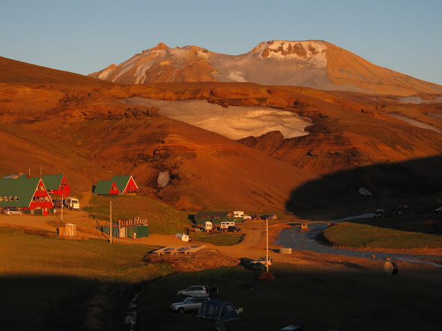
A cycle tourer had been keeping pace with us for three nights. It was clear that we weren't driving enough. After one night in Kerlingfjoll we packed up and headed off for a long day's driving, through the highlands to the coast then round the ring road towards our next destination, Lake Myvatn. On the way we saw the delightful geothermal area of Hveraviller with its steaming white pimple.


And the mighty Godafoss........


Lake Myvatn translates as Midge Lake so I had my headnet at the ready when we arrived. I mentioned above that dust was, for me, one of the defining features of Iceland. The other is flies. There were flies everywhere, a touch smaller and much slimmer than houseflies. They didn't bite so were of nuisance value only. After the first night I made like an Ethiopian and stopped resisting, allowing the flies free rein to walk around on my face and buzz in my ears. There were no mosquitos. Even at Midge Lake, in warm, still conditions, after overnight rain, there were no midges. Lots of non-biting flies but not a single midge. Maybe we were lucky, but in those conditions Scotland would be a true midge hell. When it comes to biting insects Scotland really does lead the world.


Our first port of call was the Myvatn Nature Baths, a beautifully situated outdoor heated pool that took advantage of water from an adjacent geothermal power station.

That's enough for one go, more to come.

Labels:

<data:blog.pageTitle/>

This Page

has moved to a new address:

http://livingmountain.net

Sorry for the inconvenienceā€¦

Redirection provided by Blogger to WordPress Migration Service